Introduction
Welcome to the exciting world of drone piloting! As a drone enthusiast, you already know that flying a drone is not just about capturing breathtaking aerial shots or exploring new horizons; it also involves careful planning, navigation, and adherence to safety regulations. With the rise in popularity of drones, the market has flooded with various drone apps designed to enhance your piloting experience and assist you in achieving professional-level results.
However, with so many options available, choosing the best drone app can be a daunting task. That’s where this article comes in. We’ve compiled a list of the top drone apps that are widely acclaimed among both hobbyists and professional pilots alike. Whether you’re capturing cinematic footage, conducting surveying operations, or just exploring the skies, these apps will help you make the most out of your drone’s capabilities.
But before we dive into the details, it’s essential to understand the factors you should consider when selecting a drone app. The ideal app should offer features like flight planning, real-time telemetry data, map overlays, pre-flight checklists, and geofencing capabilities. It should also be compatible with your specific drone model and provide a seamless user experience.
Next, it’s important to note that the apps listed in this article are compatible with popular drone brands such as DJI, Yuneec, Parrot, and Autel. While some features may vary depending on the drone model and app version, the core functionalities remain consistent across the board.
Now, let’s explore the top drone apps that will revolutionize your flying experience and take your piloting skills to new heights!
Factors to Consider When Choosing a Drone App
When selecting a drone app, it’s important to consider several factors to ensure you choose one that aligns with your needs and enhances your piloting experience. Here are the key factors to keep in mind:
- Compatibility: Check if the app is compatible with your drone model and operating system. Compatibility is crucial to ensure seamless integration and optimal performance.
- Flight Planning: Look for an app that offers advanced flight planning capabilities. Features like waypoint navigation, automated missions, and customizable flight paths are essential for capturing precise aerial shots.
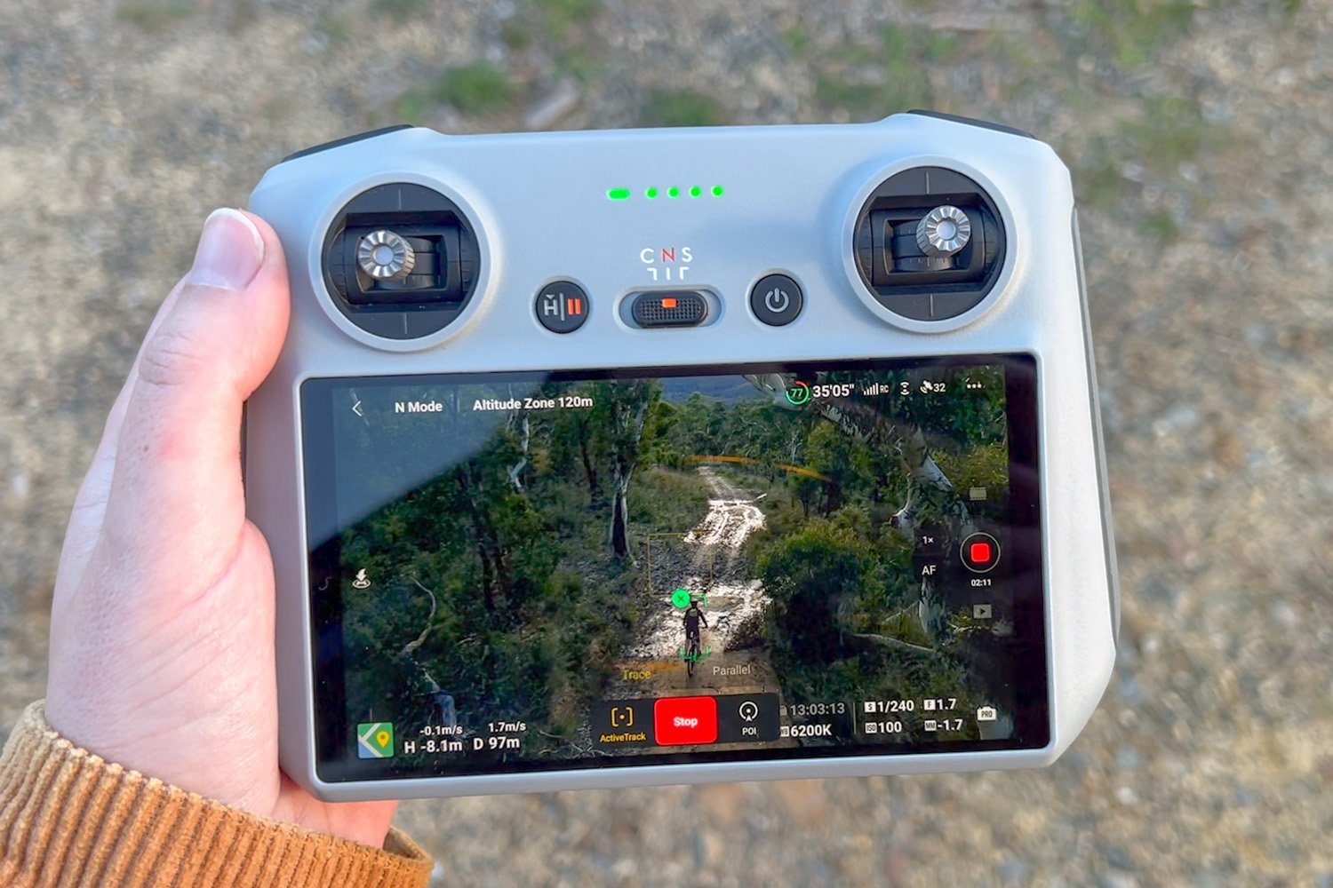
- Real-Time Telemetry Data: The app should provide real-time telemetry data such as altitude, speed, battery life, and GPS location. This information enables you to monitor your drone’s status and make informed decisions during flight.
- Map Overlays: Choose an app that provides map overlays, including airspace restrictions, weather conditions, and temporary flight restrictions (TFRs). This ensures regulatory compliance and enhances safety.
- Pre-Flight Checklists: An app with pre-flight checklists helps you perform a systematic inspection of your drone and ensures that all essential settings are properly configured before takeoff.
- Geofencing: Geofencing capabilities are crucial for maintaining safe and legal operations. Look for an app that allows you to set virtual boundaries and prevents your drone from entering restricted or no-fly zones.
- User-Friendly Interface: Opt for an app with a user-friendly interface that is easy to navigate and understand. Intuitive controls and a visually appealing layout contribute to a smoother flying experience.
- Additional Features: Consider any additional features that may be relevant to your specific needs. These could include image and video editing tools, live streaming capabilities, or integration with other devices such as VR goggles.
By considering these factors, you can narrow down your options and select a drone app that perfectly aligns with your requirements. Now, let’s dive into the top drone apps that offer a wide range of features and functionalities for both recreational and professional pilots.
Top Drone Apps for Pilots
Now that we have discussed the factors to consider when choosing a drone app, let’s explore the top drone apps that have gained popularity among pilots:
- DJI Go 4: Developed by DJI, the leading drone manufacturer, DJI Go 4 is a comprehensive app for DJI drone pilots. It offers advanced flight planning, live streaming, and editing features, allowing you to capture stunning aerial footage effortlessly.
- Litchi: Litchi is a feature-rich app that supports a wide range of drone models. It offers automated flight modes, waypoint navigation, and VR compatibility, ensuring an immersive flying experience for both recreational and professional pilots.
- AirMap: AirMap is a must-have app for pilots seeking real-time airspace information. It provides detailed maps, airspace restrictions, and situational awareness features, assisting you in complying with local regulations and enhancing flight safety.
- Pix4Dcapture: Pix4Dcapture is a specialized app for mapping and surveying operations. It enables you to plan and execute autonomous drone flights, collecting aerial imagery for creating 2D maps and 3D models with high accuracy.
- UAV Forecast: UAV Forecast is a weather-focused app that provides crucial information for safe drone operation. It offers real-time weather updates, wind speed and direction forecasts, and sunrise/sunset times, helping you plan your flights accordingly.
- Kittyhawk: Kittyhawk is a comprehensive app that offers features like pre-flight checklists, flight logging, and airspace awareness. It also provides collaboration tools for team operations, making it a go-to app for professional drone pilots.
- DroneDeploy: DroneDeploy is a powerful app designed for mapping, 3D modeling, and inspection purposes. With its automated flight modes and image processing capabilities, it simplifies complex tasks and delivers high-quality results.
- MapPilot: MapPilot is an intuitive app that focuses on aerial mapping and surveying. It offers advanced flight planning features, multi-flight missions, and compatibility with popular camera systems, making it an ideal choice for professional mapping operations.
Each of these apps has its unique set of features and capabilities. Depending on your specific needs and preferences, you can choose the app that best suits your drone piloting requirements. Whether you’re a hobbyist capturing stunning landscapes or a professional conducting commercial operations, these top drone apps will undoubtedly enhance your flying experience and unlock a world of possibilities.
DJI Go 4
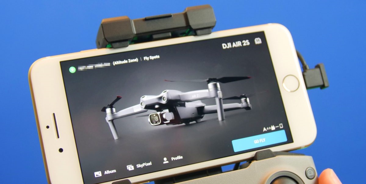
DJI Go 4 is a versatile and powerful app developed by DJI, one of the leading drone manufacturers in the industry. This app is specifically designed for DJI drone pilots and offers a wide range of features to enhance your flying experience. With its user-friendly interface and comprehensive functionality, DJI Go 4 is a popular choice among both recreational and professional pilots.
One of the standout features of DJI Go 4 is its advanced flight planning capabilities. The app allows you to create custom flight paths, set waypoint navigation, and even automate complex missions. This feature is particularly beneficial for capturing precise aerial shots or conducting professional-level operations.
Live streaming is another noteworthy feature of DJI Go 4. With just a few taps, you can stream the live view from your drone’s camera to your mobile device, providing a real-time perspective of the flight. This is extremely useful for framing shots and ensuring you capture the perfect image or video.
Furthermore, DJI Go 4 also offers post-flight editing tools, allowing you to refine your captured footage directly within the app. You can trim clips, apply filters, add music, and even create professional-looking videos on the go. This feature eliminates the need for separate editing software and streamlines the entire workflow.
In terms of flight safety, DJI Go 4 provides essential information such as battery life, signal strength, and GPS location in real-time. It also offers geofencing capabilities, allowing you to set virtual boundaries to ensure your drone does not fly into restricted or no-fly zones. With the app’s built-in flight logs, you can review past flights and track important flight data for analysis and improvement.
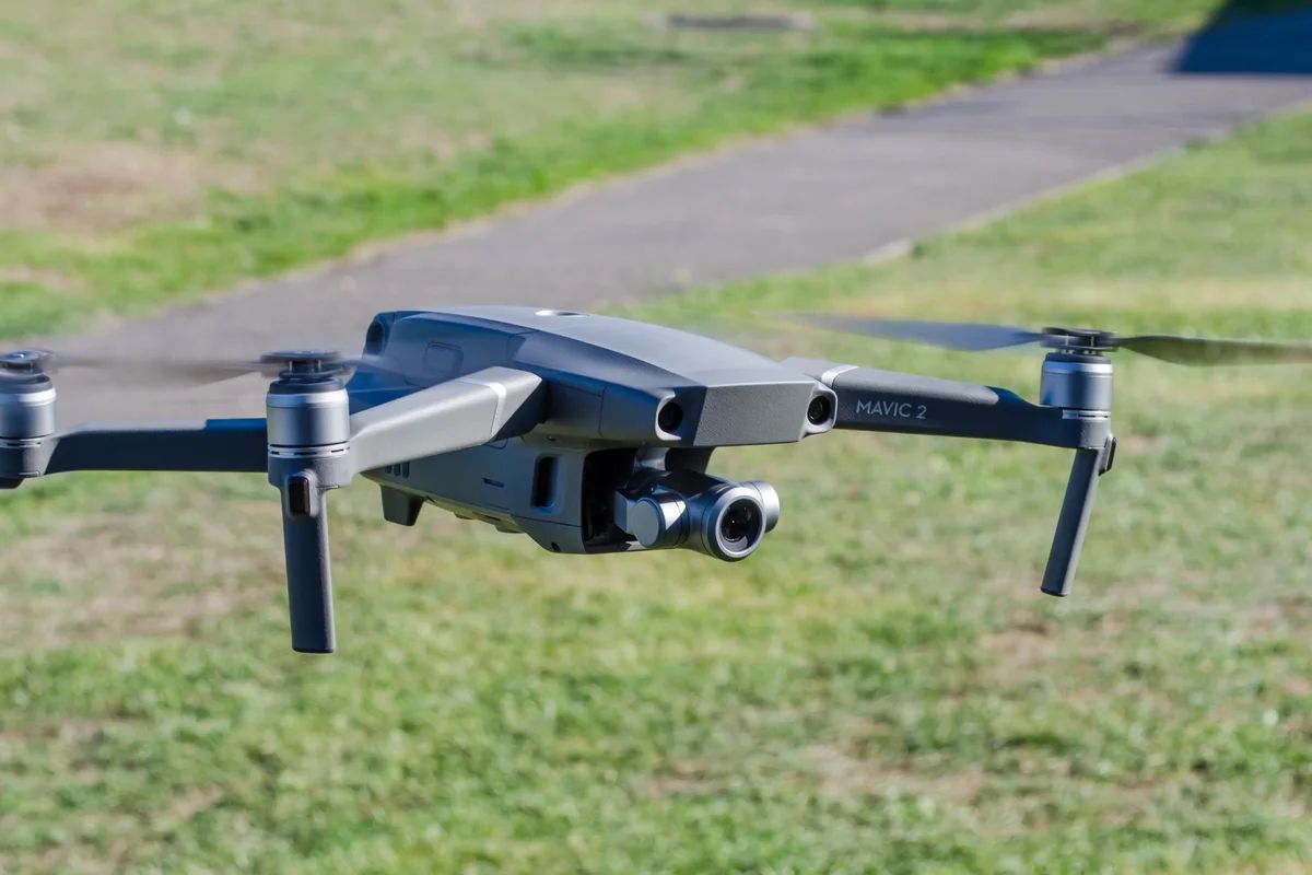
DJI Go 4 is compatible with various DJI drones, including the popular Phantom and Mavic series. It regularly receives updates from DJI, introducing new features and improvements to enhance the app’s performance. This ensures that users have access to the latest advancements and functionalities.
Overall, DJI Go 4 is a comprehensive app that caters to the needs of both hobbyists and professional pilots. With its advanced flight planning, live streaming, post-flight editing, and safety features, DJI Go 4 truly elevates the drone piloting experience to new heights. Whether you’re an aspiring aerial photographer or a seasoned professional, DJI Go 4 is a must-have app for unleashing the full potential of your DJI drone.
Litchi
Litchi is a feature-rich drone app that has gained popularity among pilots for its advanced functionality and compatibility with a wide range of drone models. Whether you are a recreational pilot or a professional photographer, Litchi offers an array of features that can take your drone flying experience to new heights.
One of the standout features of Litchi is its automated flight modes. With Litchi, you can choose from a variety of pre-programmed flight paths such as Orbit, Waypoints, Follow Me, and Focus. These modes allow you to capture stunning aerial shots with ease and precision. Whether you want to create cinematic fly-around shots or capture smooth and seamless panoramas, Litchi has the tools to make it happen.
In addition to the automated flight modes, Litchi also offers Virtual Reality (VR) compatibility. If you own a VR headset, you can immerse yourself in the drone’s perspective and experience a truly immersive and exhilarating flight. This feature adds a whole new dimension to your flying experience and allows you to explore the world from a unique vantage point.
Litchi also provides precise and reliable waypoint navigation. By plotting a series of waypoints on the map, you can instruct your drone to follow a specific flight path. This feature is particularly useful for conducting surveying operations or capturing precise aerial footage of large areas. With Litchi’s waypoint navigation, you can achieve accurate and repeatable flight paths to obtain consistent results.
Furthermore, Litchi offers a comprehensive set of camera control options. You can control camera settings such as exposure, white balance, and resolution directly from the app, giving you full control over your aerial photography or videography. Litchi also supports multi-burst capture, time-lapse modes, and even allows you to shoot in RAW format for maximum flexibility in post-processing.
Safety is also a top priority with Litchi. The app provides real-time telemetry data including altitude, speed, and battery level, ensuring that you have all the necessary information to keep your flight safe and within regulatory limits. Litchi also offers a geofencing feature that allows you to set virtual boundaries to prevent your drone from flying into restricted areas or no-fly zones.
Overall, Litchi is a powerful drone app that offers a wide range of features for pilots. With its automated flight modes, waypoint navigation, VR compatibility, camera control, and safety features, Litchi equips pilots with the tools they need to capture stunning aerial footage and explore new creative possibilities. If you are looking for a versatile and reliable drone app that can enhance your flying experience, Litchi is definitely worth considering.
AirMap
AirMap is a crucial app for drone pilots who prioritize safety and compliance. Developed with the goal of providing real-time airspace information, AirMap has gained recognition as a go-to app for both recreational and professional pilots. With its extensive database of airspace maps, flight planning tools, and situational awareness features, AirMap ensures a safe and seamless flying experience.
One of the standout features of AirMap is its interactive airspace map. The app provides detailed maps that display restricted, controlled, and no-fly zones, as well as temporary flight restrictions (TFRs). By having access to this information, pilots can quickly identify areas where drone flights are either prohibited or require special permissions. This enables them to plan their flights accordingly and comply with local regulations.
In addition to airspace maps, AirMap also offers real-time situational awareness features. The app provides notifications and alerts regarding nearby manned aircraft, weather conditions, and airspace changes. This helps pilots stay informed and make informed decisions while flying. The ability to stay up-to-date with the latest information ensures a high level of safety and reduces the risk of accidents or conflicts with other aircraft.
Flight planning is another essential feature offered by AirMap. The app allows pilots to plan their flights in advance by specifying the desired route and altitude. AirMap then analyzes the selected flight path and provides recommendations to ensure compliance with local regulations and airspace restrictions. By using AirMap’s flight planning tools, pilots can conduct their flights confidently and within the legal boundaries.
Furthermore, AirMap offers integration with other apps and devices, making it even more versatile for pilots. The app can be connected to compatible drones, allowing for direct access to airspace information and flight planning tools from within the drone’s controller. This seamless integration streamlines the flight preparation process and enhances the overall user experience.
Lastly, AirMap also provides essential information for manned aviation, including data about airports, heliports, and other key aviation facilities. This information is valuable for drone pilots as it allows them to be mindful of nearby aviation activities and make informed decisions based on the current airspace conditions.
Overall, AirMap is an indispensable app that prioritizes safety and regulatory compliance for drone pilots. With its interactive airspace map, real-time situational awareness features, flight planning tools, and integration capabilities, AirMap ensures a safe and smooth flying experience. By utilizing AirMap, pilots can navigate the skies confidently and responsibly, contributing to the overall safety and integration of drones into the aviation ecosystem.
Pix4Dcapture
Pix4Dcapture is a specialized app designed for mapping and surveying operations using drones. Whether you are a professional conducting aerial mapping or a hobbyist interested in creating detailed 3D models, Pix4Dcapture offers a range of features to help you capture accurate and high-resolution aerial imagery.
One of the standout features of Pix4Dcapture is its ability to plan and execute automated drone flights. The app allows you to define a specific flight path by setting waypoints or using grid-based missions. This ensures consistent and precise coverage of the area of interest. By automating the flight, Pix4Dcapture eliminates the need for manual control, resulting in more efficient and accurate data collection.
Additionally, Pix4Dcapture incorporates advanced image processing algorithms to ensure optimal data quality. The app captures a series of overlapping images during the flight, which are then processed to create detailed maps, 3D models, or orthomosaics. This feature is particularly useful for professionals in industries such as surveying, construction, and agriculture, as it enables them to create accurate digital representations of real-world landscapes or objects.
Pix4Dcapture offers various flight modes to cater to different mapping needs. For example, the Grid Mission mode is ideal for large area coverage, while the Circular Mission mode is suitable for capturing detailed imagery around a specific point of interest. By providing these different flight modes, Pix4Dcapture ensures flexibility and adaptability for various mapping projects.
The app also offers real-time feedback during the flight, allowing you to monitor important flight parameters such as altitude, speed, and battery life. This ensures that you have complete control and can make adjustments if needed. Additionally, Pix4Dcapture provides a live map view, giving you a visual representation of the flight path and area being covered.
Furthermore, Pix4Dcapture supports a wide range of DJI drone models, including popular ones like the Phantom and Mavic series. This compatibility ensures that many drone pilots can benefit from the app’s mapping and surveying features without the need for additional hardware or software.
In summary, Pix4Dcapture is an excellent app for drone pilots involved in mapping and surveying operations. By offering automated flight planning, image capture, and advanced data processing capabilities, Pix4Dcapture streamlines the data collection process and enables the creation of accurate maps, 3D models, and orthomosaics. Whether you are conducting professional surveys or simply exploring the possibilities of aerial mapping, Pix4Dcapture is a powerful tool that can take your drone mapping projects to new heights.
UAV Forecast
When it comes to planning a successful drone flight, having accurate weather information is crucial. This is where UAV Forecast comes into play. UAV Forecast is a weather-focused app specifically designed for drone pilots, providing essential weather data to ensure safe and successful flights.
One of the key features of UAV Forecast is its real-time weather updates. The app provides current weather conditions such as temperature, wind speed, wind direction, and precipitation probability. Having access to this information allows drone pilots to determine whether it is safe and ideal to fly their drones at a given location and time.
Wind plays a significant role in drone flight, and UAV Forecast provides wind speed and direction forecasts specific to your chosen location. This enables you to make informed decisions about when and where to fly, ensuring that wind conditions are optimal for safe and stable flight. Knowing the wind conditions in advance also helps you plan the trajectory of your flights and adjust flight parameters accordingly.
In addition to wind conditions, UAV Forecast provides other useful weather information, such as the visibility range, cloud cover, and sunrise/sunset times. These data points are essential for planning your flights and capturing optimal lighting conditions. With UAV Forecast, you can assess the best times to fly for capturing stunning aerial footage or conducting professional operations.
UAV Forecast also offers a convenient flight planning feature. By inputting your location, drone type, and desired altitude, the app provides a comprehensive overview of the weather conditions and their impact on your flight. This allows you to make informed decisions about the feasibility and safety of your planned flight.
Furthermore, UAV Forecast offers a user-friendly and intuitive interface, making it easy to navigate and understand. The app presents the weather data in a clear and concise manner, allowing you to quickly grasp the weather conditions at a glance. This simplicity and accessibility contribute to a smoother flight planning experience.
Whether you are a recreational pilot capturing breathtaking aerial shots or a professional conducting commercial operations, UAV Forecast is an invaluable tool for ensuring safe and successful flights. By providing real-time weather updates, wind forecasts, and other essential weather information, UAV Forecast equips you with the knowledge needed to make informed decisions about your drone flights. With UAV Forecast, you can fly with confidence, knowing that you have taken weather conditions into account for a safe and enjoyable flying experience.
Kittyhawk
Kittyhawk is a comprehensive drone app that offers a wide range of features designed to streamline the drone piloting experience and enhance operational efficiency. Whether you’re a recreational pilot or part of a professional team, Kittyhawk provides tools and functionality that make managing drone operations a breeze.
One of the standout features of Kittyhawk is its pre-flight checklist. The app offers a customizable list that prompts you to complete important safety checks before each flight. This ensures that your drone is in optimal condition and all settings are properly configured, minimizing the risk of accidents or malfunctions.
Kittyhawk also offers flight logging and record-keeping capabilities. The app automatically logs essential flight information such as time, location, altitude, and battery status. This data is valuable for analyzing flight performance, reviewing past flights, and maintaining a comprehensive flight history. Additionally, Kittyhawk allows you to store relevant documents such as pilot licenses, waivers, and aircraft registration information, ensuring easy access and compliance with regulatory requirements.
Collaboration is a key aspect of Kittyhawk, making it an ideal tool for professional team operations. The app enables pilots and operators to share flight plans, task assignments, and important information within the team. This enhances communication, coordination, and situational awareness during complex and collaborative operations.
Kittyhawk also offers real-time airspace intelligence. The app provides up-to-date information on airspace conditions, including temporary flight restrictions (TFRs), controlled airspace, and other regulatory restrictions. This helps pilots plan their flights more effectively and ensure compliance with local regulations.
In addition, Kittyhawk offers automated flight notifications and alerts. You can set up customized flight boundaries and receive real-time notifications if your drone enters or exits these areas. This feature is particularly useful for maintaining flight safety and keeping up with changing conditions while conducting operations in dynamic environments.
Furthermore, Kittyhawk integrates with popular drone platforms, allowing you to control your drone and access the app’s features directly from your drone’s controller. This seamless integration enhances user experience and eliminates the need for switching between multiple apps or devices.
Overall, Kittyhawk is a powerful and versatile app that caters to the needs of both recreational and professional drone pilots. With its pre-flight checklist, flight logging, collaboration features, real-time airspace intelligence, and integration capabilities, Kittyhawk simplifies drone operations and enhances safety, coordination, and efficiency. Whether you’re a solo pilot or part of a team, Kittyhawk is a valuable tool for managing and optimizing your drone operations.
DroneDeploy
DroneDeploy is a powerful app that focuses on mapping, 3D modeling, and inspection operations. Whether you’re a professional in industries such as construction, agriculture, or surveying, or a hobbyist interested in creating detailed aerial maps, DroneDeploy offers a suite of features to streamline the data collection process and deliver high-quality results.
One of DroneDeploy’s standout features is its ability to plan and execute automated flight missions. The app allows you to define the area of interest and the desired flight parameters, such as altitude and image overlap. Once the flight plan is set, DroneDeploy takes care of navigating the drone along the flight path and capturing the necessary images. This automation saves time, ensures consistent coverage, and minimizes human error in data collection.
DroneDeploy’s powerful image processing algorithms play a vital role in generating accurate and detailed maps, 3D models, and orthomosaics. The app automatically stitches the captured images together to create highly precise and georeferenced maps. This enables professionals in various industries to visualize, analyze, and share the data collected from their drone flights.
In addition to mapping, DroneDeploy offers specialized features for inspection purposes. The app allows you to annotate images, mark specific points of interest, and measure distances and areas directly on the map. This feature is particularly useful for assessing and monitoring infrastructure, agricultural crops, and construction sites from an aerial perspective.
DroneDeploy also provides advanced analytics and reporting capabilities. The app can generate customizable reports and visualizations, allowing you to gain insights and make data-driven decisions based on the collected aerial data. These insights can help improve operational efficiency, optimize resource allocation, and identify potential issues or anomalies in real-time.
Furthermore, DroneDeploy offers cloud-based storage and collaboration features. This allows you to securely store your data in the cloud and easily share it with team members or clients. The app provides a user-friendly interface for accessing and managing your projects, ensuring seamless collaboration on mapping and inspection operations.
By offering a comprehensive set of features specifically tailored for mapping, 3D modeling, and inspection, DroneDeploy empowers professionals in various industries to leverage the capabilities of drones for data collection and analysis. The app’s automated flight missions, image processing, inspection tools, analytics, and collaboration features make it an invaluable tool for professionals seeking accurate and actionable insights from aerial data.
MapPilot
MapPilot is an intuitive and feature-rich app designed for aerial mapping and surveying operations. Developed by Maps Made Easy, MapPilot offers a range of tools and functionalities that make it an excellent choice for drone pilots who require precise mapping and detailed data collection capabilities.
One of the key features of MapPilot is its ability to plan and execute autonomous flights. The app allows you to define the boundaries of your survey area and set the desired altitude and image overlap. MapPilot then generates a comprehensive flight path, ensuring complete coverage of the designated area. This automated flight planning feature saves time and effort, allowing you to concentrate on data analysis rather than manually navigating the drone.
In addition to autonomous flight planning, MapPilot offers advanced camera control options. The app provides full control over camera settings such as exposure, ISO, and image format. This level of control ensures that you capture images that are tailored to the specific requirements of your mapping or surveying project.
MapPilot also supports multi-flight missions, enabling pilots to map larger areas by resuming flights where they left off. The app automatically saves flight data and allows you to resume or continue flights, ensuring consistent data collection and seamless map stitching.
Furthermore, MapPilot offers compatibility with popular camera systems, such as Sony and GoPro. This integration allows you to use high-resolution cameras to capture detailed and high-quality imagery for mapping and surveying purposes. MapPilot’s versatility in camera compatibility expands the possibilities of your aerial data collection and analysis.
Similar to other mapping apps, MapPilot utilizes advanced image processing algorithms to stitch the captured images together and generate accurate maps, orthomosaics, and 3D models. The processed data can be exported in various formats compatible with popular GIS software, making it easy to incorporate the aerial data into your existing workflows.
Moreover, MapPilot offers user-friendly flight control features with intuitive touch-based controls. The app provides a clear and straightforward interface, allowing pilots of all skill levels to easily navigate through the app’s functionalities and fly their drones with confidence.
In summary, MapPilot is a powerful tool for pilots involved in mapping and surveying operations. With its autonomous flight planning, advanced camera control, multi-flight missions, camera compatibility, and user-friendly interface, MapPilot simplifies the data collection process. Whether you’re a professional surveyor, a land-use planner, or a researcher requiring detailed and accurate aerial imagery, MapPilot provides the capabilities necessary to capture the data you need with ease and precision.
Conclusion
Choosing the right drone app is essential for optimizing your piloting experience and unlocking the full potential of your drone. In this article, we explored the top drone apps available in the market, each offering unique features and functionalities for different purposes.
From the versatile DJI Go 4 app and its advanced flight planning and editing capabilities to the mapping and surveying prowess of Pix4Dcapture and MapPilot, these apps cater to a variety of needs and industries. Litchi provides automated flight modes and VR compatibility, while AirMap prioritizes safety with real-time airspace information. UAV Forecast focuses on providing weather data, while Kittyhawk offers comprehensive tools for collaboration and flight management. Lastly, DroneDeploy specializes in mapping, 3D modeling, and inspection operations.
When selecting a drone app, it’s important to consider factors such as compatibility with your drone model, flight planning capabilities, real-time telemetry data, map overlays, pre-flight checklists, and user-friendliness. Taking these factors into account will help you choose the app that best suits your requirements and enhances your piloting experience.
Whether you’re a recreational pilot capturing stunning aerial footage or a professional conducting commercial operations, these top drone apps will undoubtedly elevate your flying experience, streamline workflows, and enable you to capture accurate data for further analysis.
So, go ahead and explore these top drone apps to take your piloting skills to new heights. With the right app in your hands, the sky is the limit for what you can achieve with your drone.


