Introduction
Drones have become increasingly popular for recreational enthusiasts, professional photographers, and even businesses. These flying machines offer a unique perspective and the ability to capture stunning aerial footage. However, to fully exploit the capabilities of a drone, you need to use the right app that complements its features and enhances your overall experience. In this article, we will explore some of the top drone apps available in the market, helping you make an informed choice and maximize the potential of your drone.
Choosing the right app for your drone depends on various factors such as brand compatibility, desired features, and user-friendliness. Each app is designed to offer distinct functionalities, from flight controls and camera settings to mapping and waypoint navigation. By understanding the purpose of your drone use, you can select an app that aligns with your needs and enhances your aerial adventures.
In this overview, we will explore ten popular drone apps, including DJI Go 4, Litchi, GoPro App, Pix4Dcapture, AirMap, DroneDeploy, Autel Explorer, Hover, SkyPixel, and Map Pilot. Each of these apps has its own unique set of features and benefits, allowing you to optimize your drone’s performance and capture breathtaking aerial shots.
DJI Go 4
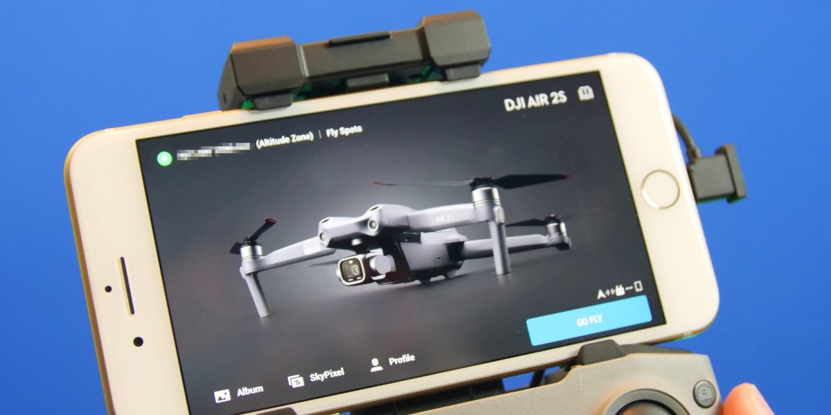
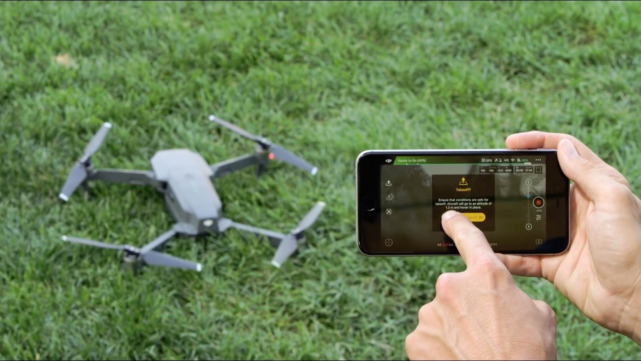
DJI Go 4 is the official app for DJI drones and is compatible with a wide range of DJI models, including Mavic, Phantom, Inspire, and Spark. This app offers comprehensive control over your drone’s flight and camera settings, providing a seamless flying experience. With DJI Go 4, you can easily navigate your drone, access flight telemetry data, adjust camera settings, and capture stunning photos and videos in real time.
One of the main features of DJI Go 4 is its advanced flight control system. It allows you to plan flight routes, set waypoints, and even enable intelligent flight modes such as ActiveTrack, which tracks and follows a subject, and TapFly, which allows you to tap on the live video feed to move the drone to that location. These features provide more flexibility and creativity in capturing dynamic shots.
Furthermore, DJI Go 4 offers a live HD video feed from your drone’s camera, allowing you to see exactly what the drone sees. This real-time feed not only helps you frame your shots accurately but also enhances the overall flying experience. The app also supports VR goggles, giving you a truly immersive experience as you pilot your drone.
In addition to flight control, DJI Go 4 provides extensive camera settings for capturing professional-grade photos and videos. You can adjust settings such as exposure, white balance, ISO, and shutter speed to get the desired shot. The app also offers automated shooting modes like panorama and time-lapse, allowing you to create stunning visual content effortlessly.
DJI Go 4 also includes a social platform called SkyPixel, where you can share your drone photos and videos with a community of aerial enthusiasts. This platform allows you to discover inspiring content from other drone users and showcase your own captures.
Overall, DJI Go 4 is a powerful and user-friendly app that offers comprehensive control over DJI drones. From precise flight controls to extensive camera settings, it provides a seamless and immersive experience for both recreational and professional drone pilots.
Litchi
Litchi is a popular third-party app that offers advanced flight features and camera controls for DJI drones. Compatible with DJI Phantom, Mavic, Inspire, and Spark models, Litchi takes your drone flying experience to the next level with its array of features.
One of the standout features of Litchi is the ability to plan and execute autonomous flights. The app allows you to plot out a flight path on a map, set waypoints, and even customize the altitude and speed of your drone along the route. This feature is especially useful for capturing smooth and cinematic shots, as it eliminates the need for manual piloting.
Litchi also offers a collection of pre-programmed flight modes, providing a range of creative options to capture unique perspectives. Follow Me mode allows the drone to track your movements automatically, while Orbit mode enables the drone to circle around a specific point of interest. Waypoint mode allows you to create complex flight paths with multiple points, giving you the ability to execute complex aerial sequences with ease.
In addition to its advanced flight modes, Litchi provides sophisticated camera controls. You can adjust camera settings such as exposure, shutter speed, and white balance directly from the app. This level of control allows you to capture professional-quality photos and videos with your DJI drone.
Litchi also supports VR goggles, providing an immersive first-person view of your drone’s flight. This feature enhances the flying experience, allowing you to feel like you’re in the cockpit as you navigate through the air.
Furthermore, Litchi offers the ability to cache maps, so you can plan and fly missions even when there is no internet connection. This is particularly useful for those who want to fly in remote areas with limited or no internet access.
Overall, Litchi is a feature-rich app that offers advanced flight planning, autonomous flight modes, and camera controls for DJI drones. Whether you’re a recreational drone enthusiast or a professional photographer, Litchi provides a powerful toolset to enhance and optimize your drone flying experience.
GoPro App
The GoPro App is a versatile companion for GoPro camera users, allowing you to control and manage your GoPro drone. This app is specifically designed to work with GoPro’s Karma drone and HERO cameras, enabling you to capture stunning aerial footage and control your camera settings with ease.
With the GoPro App, you can easily control your Karma drone’s flight and access its various flight modes. Whether you want to capture breathtaking aerial shots or perform dynamic flight maneuvers, the app provides intuitive controls and options to make it happen.
Additionally, the GoPro App offers a live, real-time video feed from your GoPro drone’s camera, allowing you to see exactly what your drone is capturing. This feature enables you to frame your shots precisely and ensures that you don’t miss any important moments during your flights.
The GoPro App also provides a range of creative features that allow you to enhance your footage. For example, you can apply filters and presets directly to your photos and videos, giving them a unique look and feel. The app also offers editing capabilities, allowing you to trim and combine clips, add music and transitions, and even apply visual effects to create professional-quality videos.
Furthermore, the GoPro App offers a convenient media management system. You can easily transfer files from your GoPro camera to your mobile device, making it effortless to share your content on social media or edit it using other apps.
Another notable feature of the GoPro App is its built-in QuikStories feature. This automatically transforms your footage into edited and shareable videos with music and effects, saving you time and effort in creating engaging content.
Overall, the GoPro App is a comprehensive solution for GoPro Karma drone users. It provides seamless control over your drone’s flight, access to real-time video feed, advanced editing features, and a streamlined media management system. With the GoPro App, you can unleash your creativity and capture stunning aerial footage like never before.
Pix4Dcapture
Pix4Dcapture is a powerful app designed for professional aerial mapping and surveying using drones. This app is an essential tool for industries such as construction, agriculture, and land surveying, as it allows for accurate and detailed mapping of large areas.
One of the key features of Pix4Dcapture is its ability to plan and execute autonomous mapping missions. The app allows you to define the area you want to map, set the desired resolution, and even specify the overlap between images. Once the mission parameters are set, Pix4Dcapture will automatically plan the flight path and capture the necessary images.
Additionally, Pix4Dcapture supports different flight modes to ensure comprehensive data collection. It offers Grid and Double Grid flight modes, which capture images in a systematic grid pattern, ideal for mapping large areas. Circular and Free Flight modes are also available for capturing close-up details or points of interest.
After the images are captured, Pix4Dcapture can automatically process them using Pix4D’s advanced photogrammetry technology. This creates highly accurate 2D maps, 3D models, and point cloud data that can be used for accurate measurements, volume calculations, and even 3D modeling.
Pix4Dcapture also provides support for multiple drone platforms, including DJI, Parrot, and Yuneec. This ensures compatibility with a wide range of popular drones, allowing professionals to utilize their existing equipment for data collection.
Furthermore, the app offers a seamless integration with Pix4D’s cloud-based data processing platform, Pix4D Cloud. This allows for easy uploading and processing of the captured data, providing access to comprehensive analysis and reporting tools.
In summary, Pix4Dcapture is an essential app for professional applications such as aerial mapping, surveying, and 3D modeling. With its autonomous mission planning, support for various flight modes, and integration with advanced data processing platforms, Pix4Dcapture empowers professionals to efficiently and accurately collect and analyze data from the air.
AirMap
AirMap is a comprehensive app designed for drone pilots to ensure safe and responsible flying. It provides valuable information about airspace regulations, weather conditions, and nearby obstacles, allowing pilots to plan their flights with confidence.
One of the main features of AirMap is its airspace map, which shows the various airspace restrictions and regulations in a particular area. This includes restricted airspace, no-fly zones, and temporary flight restrictions due to events or emergencies. By using AirMap, drone pilots can easily identify where it is safe and legal to fly, avoiding potential conflicts with manned aircraft and sensitive areas.
AirMap also provides real-time information about weather conditions, including wind speed, temperature, and precipitation. This helps pilots make informed decisions regarding their flights and ensures that they are aware of any weather-related risks that could affect their drone’s performance or safety.
In addition to airspace and weather information, AirMap also offers a feature called “Fly Now,” which allows pilots to quickly find nearby areas where flying is allowed and safe. This feature saves time and effort in searching for suitable locations to fly, especially in unfamiliar areas.
Furthermore, AirMap offers a flight planning tool that allows pilots to plot their intended flight path and receive real-time notifications about any potential conflicts or hazards. This helps pilots make adjustments to their route to ensure a safe and smooth flight.
AirMap also provides integration with various drone manufacturers, allowing for seamless flight planning and real-time airspace updates directly from the drone’s control interface.
Moreover, AirMap offers a feature called “Digital Notice and Awareness System” (D-NAS), which enables authorities, such as airport operators or emergency responders, to communicate important information and notices directly to drone pilots in the area. This enhances safety and situational awareness for both drone pilots and other stakeholders.
Overall, AirMap is a valuable app for drone pilots, providing essential information for safe and responsible flying. From airspace regulations and real-time weather updates to flight planning and communication tools, AirMap empowers pilots to make informed decisions and fly their drones with confidence.
DroneDeploy
DroneDeploy is a powerful app designed for professionals in industries such as construction, agriculture, and surveying. It offers advanced visualization and mapping capabilities, transforming drone data into meaningful insights and actionable information.
One of the key features of DroneDeploy is its ability to create high-resolution 2D maps and 3D models of surveyed areas. By capturing images during a flight mission, the app uses advanced photogrammetry algorithms to stitch these images together, resulting in accurate and detailed maps that can be used for analysis and decision-making.
DroneDeploy also provides specialized tools for agricultural applications. It offers crop health analysis, allowing farmers to assess the health and vigor of their crops using aerial imagery. This can help identify areas of stress, pests, or nutrient deficiencies, enabling targeted interventions and improved crop management.
Additionally, DroneDeploy offers tools for contour mapping and volumetric calculations, which are particularly useful for construction and land development projects. These features allow professionals to accurately analyze terrain elevation, measure cut and fill volumes, and plan excavation and grading activities with precision.
In addition to its mapping and analysis features, DroneDeploy offers integration with various third-party apps and platforms. This allows professionals to streamline their workflow by connecting DroneDeploy with their existing tools for data analysis, project management, and reporting.
Furthermore, DroneDeploy provides a collaborative platform where teams can easily share and access drone data, maps, and reports. This facilitates effective communication and collaboration among team members, ensuring that everyone has access to the most up-to-date information.
DroneDeploy also offers autonomous flight planning capabilities, allowing users to define the parameters of their flight missions and execute them without manual piloting. This saves time and effort, particularly for large-scale mapping or surveying projects.
Overall, DroneDeploy is an indispensable tool for professionals in industries that require accurate mapping, data analysis, and visualizations. With its advanced mapping capabilities, specialized tools for agriculture and construction, integration options, and collaborative platform, DroneDeploy empowers professionals to turn drone data into valuable insights and make informed decisions.
Autel Explorer
Autel Explorer is the official app for Autel Robotics drones, including the popular Autel EVO series. Designed to provide seamless control and advanced features, Autel Explorer offers a user-friendly interface and a range of capabilities for both recreational and professional drone pilots.
One of the standout features of Autel Explorer is its intuitive flight control system. The app allows you to easily navigate your drone, adjust flight parameters, and access telemetry data in real time. The precise control and responsive interface ensure a smooth and enjoyable flying experience.
Autel Explorer also offers an array of autonomous flight modes that can enhance your aerial photography and videography. These modes include Orbit, Waypoint, and Follow Me, allowing you to capture cinematic shots and dynamic movements without manually piloting the drone.
Furthermore, Autel Explorer provides comprehensive camera control options, enabling you to adjust settings such as ISO, shutter speed, and white balance to capture the perfect shot. The app also supports a range of intelligent shooting modes, such as HDR and Burst, which help you capture stunning images with ease.
The app offers a live video feed from your drone’s camera, ensuring that you have a real-time view of what the drone is capturing. This feature allows you to frame your shots accurately and make necessary adjustments during the flight.
Autel Explorer also provides a well-designed interface for accessing and managing your drone’s media files. You can easily download, delete, and share your photos and videos directly from the app, making it convenient to showcase your aerial adventures.
In addition, Autel Explorer offers advanced flight safety features, including geofencing and obstacle avoidance capabilities. These features help prevent accidents and keep your drone and the surrounding environment safe.
Overall, Autel Explorer is a feature-rich app that offers seamless control, advanced flight modes, comprehensive camera controls, and intuitive media management. Whether you’re a novice or an experienced pilot, Autel Explorer provides the tools you need to capture stunning aerial footage and unleash your creativity.
Hover
Hover is an essential app for drone pilots, providing valuable flight planning, weather monitoring, and airspace awareness features. Designed to ensure safe and responsible flying, Hover offers a user-friendly interface and a wealth of information to enhance your drone flying experience.
One of the key features of Hover is its comprehensive flight planning capabilities. The app allows you to easily plan and visualize your flights, set waypoints, and define flight routes. This feature ensures that you can carefully plan your drone’s path and capture the desired shots efficiently.
Hover also provides real-time weather updates, including wind speed, temperature, and precipitation. By monitoring the weather conditions, you can make informed decisions on when and where to fly your drone. This helps to ensure the safety of your drone and the quality of your aerial footage.
Furthermore, Hover offers detailed airspace information, displaying restricted areas, no-fly zones, and temporary flight restrictions on a map. This allows you to stay compliant with aviation regulations and avoid any potential conflicts with manned aircraft or sensitive areas.
In addition to flight planning and airspace awareness, Hover offers a flight logging feature. The app enables you to keep track of your flight history, including flight duration, distance, and altitude. This feature helps you monitor your flying progress and keep a record of your aerial adventures.
Another noteworthy feature of Hover is its community-based platform. The app allows you to connect with other drone pilots, share your flights, and discover new flying locations. This creates a sense of community and provides opportunities for learning and inspiration.
Hover also offers a flight readiness checklist that ensures you have completed all the necessary pre-flight checks before taking off. This helps to prevent any avoidable accidents or errors during your flights.
Overall, Hover is an indispensable app for drone pilots, providing flight planning, weather monitoring, airspace awareness, and community features. Whether you’re a recreational flyer or a professional pilot, Hover helps you fly your drone safely and responsibly, maximizing your enjoyment and the quality of your aerial experiences.
SkyPixel
SkyPixel is a vibrant social platform designed specifically for drone enthusiasts and aerial photographers. It serves as a hub for drone pilots to showcase their stunning drone photos and videos, connect with like-minded individuals, and gain inspiration from the drone community.
One of the main features of SkyPixel is the ability to easily upload and share your drone photos and videos. The platform provides a user-friendly interface, allowing you to showcase your aerial captures in high quality to a wide audience. This feature gives you the opportunity to receive feedback, recognition, and engagement from fellow drone enthusiasts.
SkyPixel also offers various categories and contests, encouraging drone pilots to participate and submit their best work. These contests provide a platform for professional and amateur photographers alike to showcase their talent and creativity. Winning entries gain exposure and can even lead to the recognition of industry professionals.
Additionally, SkyPixel offers a wealth of inspiration for drone pilots. You can explore a vast collection of drone photos and videos from around the world, discovering unique and breathtaking perspectives. This feature allows you to gain inspiration for your own aerial photography and explore different artistic styles and techniques.
Moreover, SkyPixel provides a community-driven forum where drone pilots can engage in discussions, ask questions, and share valuable insights and experiences. This fosters a sense of collaboration and learning within the drone community, enabling pilots to exchange knowledge and stay up-to-date with the latest trends and developments in the industry.
SkyPixel also features a professional platform, specifically designed for commercial aerial photographers and videographers. This platform offers a marketplace for drone-related services and connects professionals with potential clients and job opportunities.
Overall, SkyPixel is a vibrant and dynamic social platform for drone enthusiasts and aerial photographers. It provides a space for sharing, inspiration, collaboration, and professional opportunities. By joining this community, you can connect with fellow drone pilots, gain recognition for your work, and stay at the forefront of the rapidly evolving world of drone photography and videography.
Map Pilot
Map Pilot is a comprehensive mapping app designed for professionals in industries such as surveying, agriculture, and construction. It offers advanced features and precise control over drone flight missions, allowing users to capture accurate and detailed aerial maps effortlessly.
One of the standout features of Map Pilot is its ability to plan and execute autonomous mapping missions. The app allows you to define the area you want to map, set the desired resolution, and specify the overlap between images. Once the mission parameters are set, Map Pilot will automatically plan the flight path and capture the necessary images.
The app offers various flight modes, including grid, circular, and double grid, allowing for flexibility in capturing different types of maps and survey data. These flight modes ensure comprehensive coverage and provide flexibility to adapt to different mapping requirements.
Map Pilot also provides precise control over flight altitude and speed, allowing users to optimize mission performance based on their specific needs. This level of control ensures accuracy and enables professionals to capture highly detailed and accurate maps and orthomosaics.
Moreover, Map Pilot offers advanced data processing options, allowing users to generate highly accurate 2D orthomosaics, 3D models, and digital elevation models (DEMs). These data outputs can be further analyzed and used for various applications, such as terrain analysis, volume calculations, and planning.
Additionally, Map Pilot supports seamless integration with popular cloud-based data processing platforms and GIS software. This enables professionals to directly export their drone-captured data to their preferred software for further analysis and visualization.
Map Pilot also provides real-time flight telemetry and monitoring, allowing users to track their drone’s flight path, altitude, and battery status. This feature enhances situational awareness and provides valuable information during the flight operation.
Overall, Map Pilot is an essential tool for professionals in aerial mapping and surveying. Its advanced planning capabilities, precise control over flight missions, and seamless integration with data processing platforms make it a powerful app for capturing accurate and detailed aerial maps for various industries.
Conclusion
Choosing the right app for your drone is essential to enhance your flying experience, optimize your drone’s performance, and unleash your creativity. In this article, we explored ten top drone apps, each offering its own unique features and benefits.
DJI Go 4 provides comprehensive control over DJI drones, allowing for precise flight controls and advanced camera settings. Litchi offers advanced flight planning and autonomous flight modes, allowing for creative and cinematic shots. The GoPro App integrates seamlessly with GoPro cameras and the Karma drone, providing intuitive control and advanced editing options. Pix4Dcapture excels in mapping and surveying applications, generating detailed 2D maps and 3D models. AirMap ensures safe and responsible flying through its airspace awareness and real-time weather updates.
DroneDeploy offers advanced mapping and analysis capabilities, specifically designed for professionals in various industries. Autel Explorer provides seamless control and advanced features for Autel Robotics drones. Hover offers flight planning, weather monitoring, and airspace awareness features to ensure safe and responsible flying. SkyPixel serves as a vibrant social platform for drone enthusiasts, allowing for sharing, inspiration, and community engagement. Map Pilot offers advanced mapping capabilities and precise control over flight missions, enabling professionals to capture accurate and detailed aerial maps.
Each of these apps caters to different needs and objectives, from recreational flying to professional applications. By understanding your specific requirements, you can choose the app that aligns with your goals and enhances your drone flying experience. Whether you are capturing stunning aerial photos and videos, mapping large areas, or engaging with the drone community, these apps provide valuable tools and features to maximize your creative output and aerial adventures.
So, get ready to take your drone flying to new heights with the right app by your side. Explore the features, experiment with different functionalities, and enjoy the incredible possibilities that come with integrating technology and creativity in the world of drones.


