Google Maps navigation is now a normal everyday thing for a lot of us. It is unheard of these days that one does not access Google Maps when traveling on the road. This is especially true for commuters who are looking for information about their commute. Such information includes distance of commute, commute time, alternate routes and traffic alerts.
Google Maps offers a lot of features. But, there are a lot of features people do not hear about that would surely improved commuter experience. In this guide, we will be looking at some Google Maps navigation tips that will turn you into a pro commuter.
Introduction to Google Maps navigation
From maps to apps: a brief history of navigation

Navigation started during prehistoric times up to 4,000 years ago. Back then, there were already maps. But, these maps are largely for aesthetic purposes and were widely inaccurate. As a result, these maps are completely useless. Navigators back then relied on things such as the position of the sun and stars to know their direction.
Soon, compasses became a thing. These compasses are ideally pointing north through the use of magnets. But, even these compasses are inaccurate and even inconsistent. This is due to the misunderstanding of magnets back then. Still, these compasses were useful in determining direction.
With an understanding of how direction works, people now thought that maps are useful. By the thirteenth century, people started making maps with compass roses on them. How this works is that people created maps focused on important places. These places can take the form of a city, a port or a trading center. Then, these maps record the direction from one place to another using a compass rose. Compass roses show directions originating from a single place.
Despite the presence of compass roses, maps are still inaccurate. Maps back then showed the rough location of a place is but not the accurate location of it. Maps back then were basically paintings. Some maps do show things such as buildings and their location relative from the mapmaker’s perspective. While it gives an idea where things are, it is still not good enough to get people to places.
The making of maps improved as mathematical calculations, science and technology improved. Math allowed for the accurate measurement of the distance between places possible. These measurements are then recorded in scale into maps. The development of flight in the twentieth century allowed for more accurate shapes in maps.
The introduction of satellite imagery allowed for maps to become more accurate. Maps are now largely based on how the satellite imagery of a location looks like. Also, maps have updated their form. From maps in paper form, it transformed into digital maps. The first such digital map was the global positioning system. This allowed users to see their current location and to be directed to their direction by following a course displayed on the map.
This would evolve into map apps such as the likes of Google Maps. Aside from being a map, it also comes bundled with other functions. Such functions include directions, traffic, and advisories. These functions are displayed as an overlay on top of a map.
What is Google Maps?
Google Maps is a map service ran by Google. This service mainly provides satellite imagery of the entire world. Its features also include street maps, panoramic views, traffic conditions, and route planning. Google Maps is popular with more than one billion people using the service every month.
Google Maps began as a program designed by Where 2 Technologies, which is an Australia-based company. At first, users separately downloaded the program in order for them to use it. But, in October 2004, Google bought the program which led to it becoming a web-based service.
In February 2005, Google announced the launch of Google Maps. At this point, Google had integrated other technologies into Google Maps. This included some core technology from Google Earth and real-time traffic analysis.
Google has introduced a lot of features for Google Maps ever since its launch. In 2007, it added a feature for Google Maps to show the current location of a user. It also started to provide street view and traffic data in the same year. User-submitted edits and changes to Google Maps started in 2011 but has stopped by 2017. Google Maps also allows users to generate their own custom maps based on their maps.
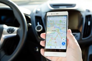
In September 2008, Google launched the mobile app version for Google Maps. This app is available for use on devices with Android and iOS mobile operating systems. Up until the launch of iOS 6 in 2012, Google Maps was the default map service for iOS before Apple Maps replaced it.
The app version of Google Maps has added functionality. This includes features such as turn-by-turn navigation and public transit information. By the end of 2015, offline functionality for Google Maps became available. This allows users to use the service without the need for an Internet connection. But, offline functionality is only limited to a specific amount of area.
Google Maps navigation tips
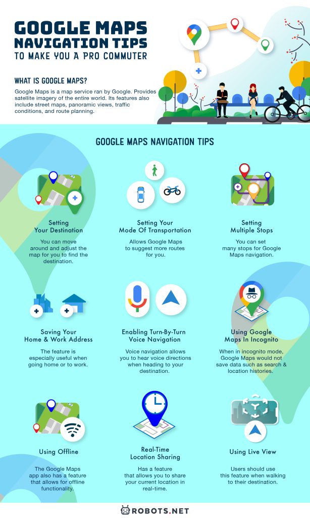
Here are some Google Maps navigation tips that allow you to make full use of the service’s features. Before you set course on your journey, be sure to use a car phone holder for safer, hands-free driving.
Setting your destination
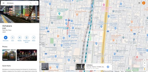
The first step in Google Maps navigation is setting your destination. Setting your destination on Google Maps can be mistaken as difficult to do. But, the features of Google Maps makes this a very easy thing to do.
One way to set your destination for Google Maps navigation is to mark it on the map. To do this, find the destination to mark on Google Maps. You can move around and adjust the map for you to find the destination.
On the desktop version, you can move the map in any direction by holding left-click and dragging to the desired direction. You can also use the arrow keys to move the map. On the app version, you can swipe using one figure to move the map to any direction you want.
You can adjust the map by zooming in and out. On the desktop version, you can do this using the zoom settings on the screen. Pressing the plus sign zooms the map in while the minus sign zooms it out. On the app version, swiping two fingers on the screen activates the zoom settings. Swiping both fingers away from each other zooms the map in. Swiping both fingers towards each other zooms it out.
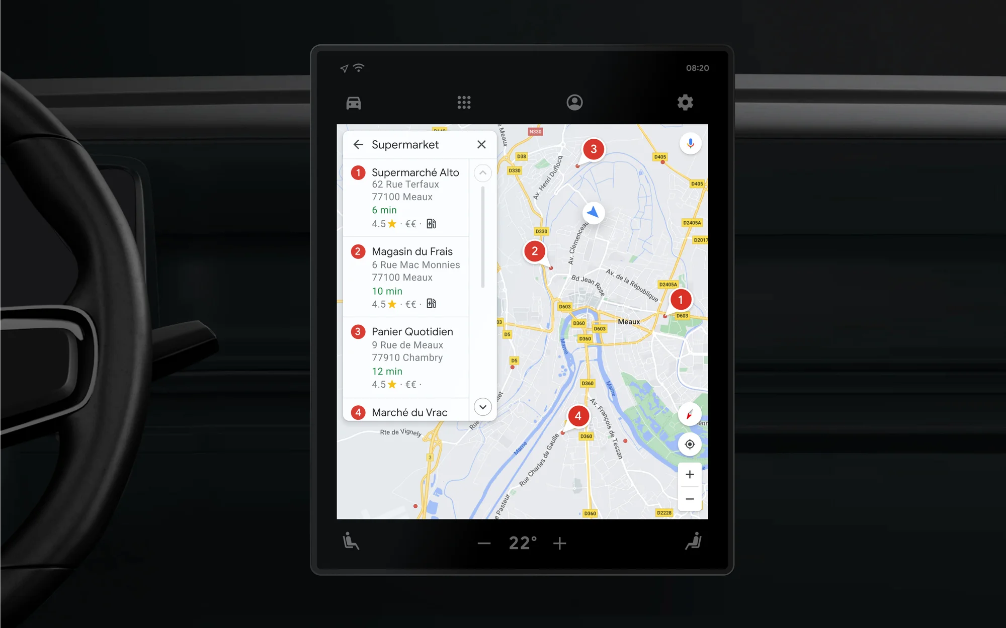
You can also find the destination by searching it on Google Maps. On the Search Google Maps bar, insert your intended destination. You can either type in the name of the destination or its full address. If you are unsure of the name or address of the destination, you can insert keywords instead. Google Maps will suggest places that could be the destination that you are looking for.
Then, to finish setting your destination for Google Maps navigation, place a marker on the map. On the desktop version, left-clicking on the destination on the map places a marker on it. On the mobile version, you can place a marker by tapping on the destination. Markers are also automatically placed when you use the Search Google Maps bar.
Setting your mode of transportation
You can set up your mode of transportation for Google Maps navigation. Setting up your mode of transportation allows Google Maps to suggest more routes for you. Google Maps has a wide number of transportation modes that it supports. So, expect that Google Maps has suggestions that fit everyone’s preferred transportation modes.
Your mode of transportation can be set when accessing Google Map’s direction feature. You will see six options for the mode of transportation. The first one is driving which has a car icon and shows possible routes for car driving. The second one is transit which has a train icon and shows possible routes using public transport. The third one is walking which has a walking man icon and shows walking routes and elevation along the way. The fourth one is cycling which has a cycling man icon and shows cycling routes. The fifth one is flights which has a plane icon and shows all possible flights to the destination. The sixth one is recommended travel mode which suggests the fastest route when mixing all modes. For some locations, there is the seventh mode. This is two-wheeler that has a motorcycle icon and shows routes fir for motorcycles.
For Android users, you can set up a default mode of transportation for Google Maps navigation. This can be set up using Google Assistant.
First, go to Google settings. Then, tap the three horizontal bar icon and select Settings. Find Google Assistant and tap the Settings under it. After that, go to Account and then tap Preferences. Finally, tap Getting around. Under this, it asks you your mode of transportation on most days or your usually used mode. Tap on your preferred mode of transportation under these two questions. This should set the default mode of transportation for Google maps navigation.
Setting multiple stops
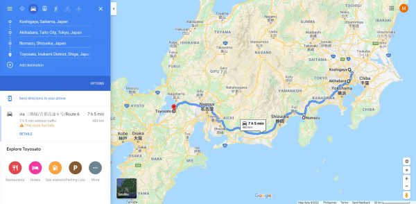
For those who are making many stops in a single trip, Google Maps has a feature fit for you. You can set many stops for Google Maps navigation.
To do this, access the Directions feature on Google Maps. Set up your starting point and your first destination. Then, to add another stop, click on Add which has a plus icon. Once there is a new spot for another stop, choose the destination by clicking it on the map or placing the destination name. You can add more stops for a number of times.
There is also an option to edit the order of the many stops inserted. To do this, click on the stop that you wish to change its order. Then, drag it to the desired order.
Saving your home and work address
Google Maps has an option to save your home and work address. This feature makes setting directions for Google Maps navigation less of a hassle. It skips the process of still looking for your home or work on Google Maps. The feature is especially useful when going home or to work.
On your desktop, you can set this up by first signing in your Google Maps. Then, head to Menu. Go to Your places and after that, to Labeled. Select either Home or Work. Then, insert your home or work address to finally set it up.
Once your home and work address is set, you can use this for Google Maps navigation. Simply type in Home or Work when inserting the starting point or destination. This automatically places in your home or work address.
You can make edits to your home and work address on Google Maps. To do this, type in Home or Work in the search box. Select the address you want to edit and then, select Edit. Type in the new address and click on Save to have it set.
To delete your home and work address on Google Maps, you can start by heading back to the Labeled settings. Beside your home and work address is an X that when clicked will delete it.
You can also set up your home and work address for the Google Maps app on Android and iOS. To do this, just tap Saved and then Labeled. Then, select Home or Work and insert your home or work address. To edit your home or work address, tap More then select Edit Home or Edit Work. To delete your home or work address, select Remove home or Remove work under the More option.
On the Google Maps app, you can see your usual route to home or work. This is possible when you enable Location History. You can turn this option off by going to Account Circle, then Settings and then to Personal content. Turning off the Regular routes option under this will disable the feature.
There is also an option to set an icon for your home or work address. Head back to the Home or Work settings under Labeled and choose Change icon. After that, select the icon you want to use for your home or work address. Press Save to finally set the icon for your home or work address.
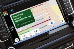
Enabling turn-by-turn voice navigation
The Google Maps app has a feature for turn-by-turn voice Google Maps navigation. This feature is available when using the Directions feature. Voice navigation allows you to hear voice directions when heading to your destination. You can also hear if there are alerts such as traffic, construction and crashes along the way.
To start turn-by-turn voice directions, go to Account Circle. Under this, select Settings and then look for Navigation settings. The Voice level settings are under this. You can choose different voice levels such as Louder, Normal or Softer. On iOS devices, you can adjust voice levels using your car’s volume controls by pairing it through CarPlay.
You can also mute, unmute or hear alerts. You can adjust this option by tapping on the Sound icon while using the Directions feature. Under Sound, there are three options. Pressing on Mute will mute the alerts. Pressing Sound will unmute the alerts. Finally, pressing on Alerts will allow you to hear alerts.
You can play the voice directions on Google Maps by using phone or tablet speakers. Voice directions are also heard through the use of car speakers. To do this, pair your phone or tablet with your car’s speakers using Bluetooth. Then, go to Account Circle, then Settings and then to Navigation settings. Under this, you have two options. Turning on Play voice over Bluetooth will play the voice directions on the car speakers. Turning off Play voice over Bluetooth will play the voice directions on the phone or tablet speakers.
For iOS devices, you can hear the voice directions on car speakers through the use of a USB cable. Simply connect your phone or tablet to your car speakers using a USB cable. Then, turn off Play voice over Bluetooth. The voice direction will now come from your car speakers.
Using Live View
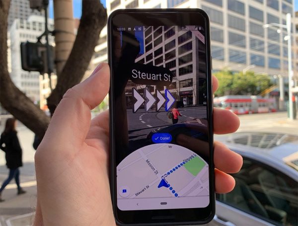
The Google Maps app has a feature called Live View. This feature allows you to do Google Maps navigation in real-time using your device’s screen. Users should use this feature when walking to their destination.
To activate Live View, you need to set your mode of transportation to Walking. Once this is set, an option for Live View will appear. Then, set up Live View by following on-screen instruction to help Google Map find where you are. It will help a lot if you would point your phone camera on buildings and street signs. Once Live View is set, you will see the directions to your destination on your phone’s screen.
When in Live View mode, there is no need to use the phone the whole way to your destination. Once Live View is set and you received directions, you can put your phone away. The phone will vibrate once you reach the next checkpoint or destination. You can go back to Live View by simply tilting the phone to a vertical position or by pressing Live View again.
You can get the best Live View experience when you are using it on places with good Street View coverage. It will also help if you are in a bright place outdoors and pointing your phone camera on buildings and street signs. Also, make sure that you are using devices compatible with ARKit or ARCore.
To know more about this feature, check our article on Google AR Maps.
Using offline
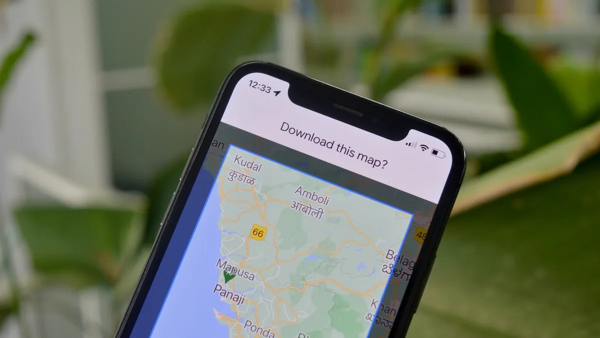
The Google Maps app also has a feature that allows for offline functionality. This means that it is possible to do Google Maps navigation with no Internet connection. Such a feature is useful for places where the Internet or WiFi connection is not available.
For you to do offline Google Maps navigation, you would need to download a map. Start by searching for a place on Google map. Then, tap the name of the place and press Download. For places such as buildings or businesses, tap More and then Download offline map.
If you do not want your device to take too much space, you can save maps on SD cards. This option is available for Android devices. To do this, you need to insert an SD card. Then, head for the Account Circle and select Offline maps. Go to Settings, then to Storage preferences and select Device. From there, select SD card.
Once you have downloaded a map, you can now use it offline on Google Maps. When offline, you can still get directions, use navigation and search locations. But, directions are only limited for driving directions. Other transportation modes are not available.
Using Google Maps in incognito
You can do Google Map navigation in incognito mode on its app version. When in incognito mode, Google Maps would not save data such as search and location histories. This feature is for people who are conscious of their privacy using web-based services.
To turn on incognito mode, tap on your profile picture. Then, select Turn on Incognito mode. To turn it off, tap on your profile picture again and select Turn off Incognito mode.
There are features that will not work on Google Maps’ incognito mode. Notable features include:
- Commute
- Location History
- Location Sharing
- Search History
- Search suggestions
- Offline maps
Real-time location sharing
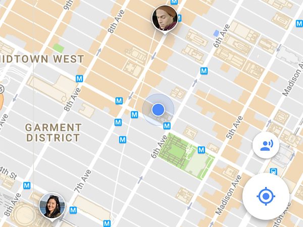
Google Maps has a feature that allows you to share your current location in real-time. This is a really useful feature for Google Maps navigation. This is especially useful for people who are meeting up somewhere.
To activate real-time location sharing, click on Menu on Google Maps. Then, click on Location sharing. After this, you need to choose the person you are going to share your live location with.
To stop real-time location sharing, go back to Location sharing. Then, find the person you are sharing your live location with. Pressing Remove beside their name will stop the real-time location sharing.
On the Google Maps app, you can activate live location by heading to Account Circle. Then, tap Location sharing and then tap Add people after that. Choose how long you will share your location. After this, tap Select People and choose the people you will share your live location with. Press Share to start sharing your live location.
If the people you want to share your live location with do not have a Google account, press More after Add people. Then, press Copy to clipboard. This will copy a link that when sent to others will allow them access to your live location for a set time.
Aside from live location, you can also share your route and estimated time of arrival. Simply head to Share trip progress, choose a person to share it with and tap Share. If you are commuting on public transit, you can also share its route too. Just head to Share trip, select the person to share it with and tap Share.
Benefits of Commuting Using Google Maps Navigation
It is an already established fact that Google Maps is a go-to app for directions. This is because of its many features that make finding your way to places less of a hassle. This service is for people who are commuting and are curious to know the fastest way to get to places.
This is where the features for Google Maps navigation is beneficial for commuters.
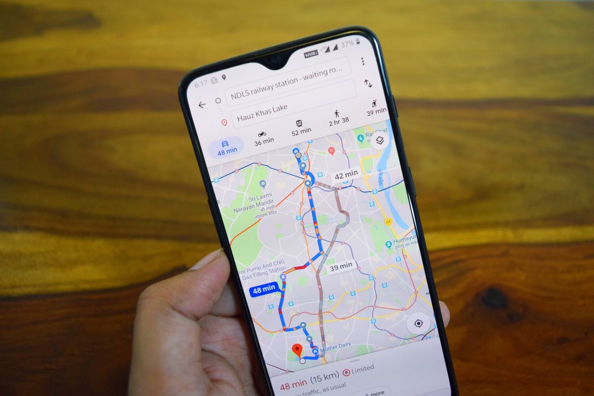
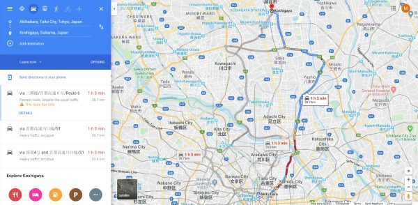
One such benefit is its ability to give more than one commute route. When making use of its directions feature, Google Maps offer many routes to choose from. While it will highlight what it thinks is the fastest route to take, it also presents alternates. These alternates are there based on factors such as the number of rides, commute time and traffic conditions. This is helpful when commuters face the risk that public transit may not be always available. Also, this is beneficial when traffic conditions in your commute suddenly change.
Another benefit is your ability to set more than one route. This is useful especially if you have other places rather than your destination. It allows you to be more flexible with your commute. You are confident that whatever changes you do to your commute, Google Maps is able to adjust.
Lastly, Google Maps helps you visualize the length of your commute. The app measures the distance of your commute and the time it takes for you to complete it. This allows you to plan ahead especially when you have a tight schedule. It also helps you to make the best decisions on what transportation to take during your commute.
You can know more about Google Maps’ other features by checking out this article on Google Maps app features. You can also check out this list of Google Maps hidden features.