Introduction
Welcome to the world of drones and the exciting possibilities they bring! In recent years, drones have rapidly gained popularity in various industries, revolutionizing the way tasks are accomplished. From aerial photography to structural inspections, these unmanned aerial vehicles (UAVs) are transforming the way we gather data and make informed decisions.
One of the key applications of drones is in the field of mapping and surveying. With their ability to capture high-resolution aerial imagery and gather data in real-time, drones have become an invaluable tool for professionals in industries such as agriculture, construction, mining, and environmental monitoring.
Among the many drone mapping software options available today, DroneDeploy stands out as a leading platform that simplifies the process of creating accurate and detailed maps. Whether you are a professional pilot or a novice enthusiast, DroneDeploy offers a user-friendly interface coupled with advanced features that make aerial mapping accessible to everyone.
The power of DroneDeploy lies in its ability to transform thousands of aerial images into actionable insights. By stitching together these images using sophisticated algorithms and employing robust cloud processing, DroneDeploy can generate highly accurate maps, 3D models, and orthomosaics.
With DroneDeploy, users can plan their flight missions, remotely control their drones, and seamlessly collect data. This data can then be further analyzed using DroneDeploy’s suite of powerful tools, allowing users to measure distances, volumes, and areas accurately.
Additionally, DroneDeploy offers integrations with popular software platforms, enabling easy collaboration and data sharing across teams. This ensures that all stakeholders have access to the same up-to-date information, facilitating efficient decision-making.
Whether you are a farmer looking to monitor crop health, a construction manager inspecting a site, or an environmentalist conducting research, DroneDeploy offers the capabilities to make your work more efficient, accurate, and impactful.
Next, we will delve deeper into the key features of DroneDeploy and explore how they can benefit different industries. So, hold on to your seats as we take you on an exciting journey through the world of DroneDeploy!
What are drones?
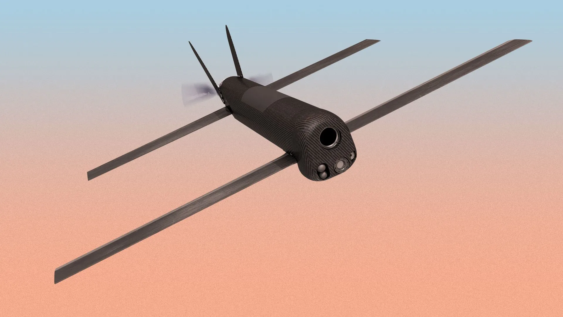
Before we dive into the specifics of DroneDeploy, let’s first understand what drones are and how they have revolutionized various industries. Drones, also known as unmanned aerial vehicles (UAVs), are aircraft that are operated remotely or autonomously without a pilot on board.
These cutting-edge devices are equipped with GPS systems, sensors, cameras, and other advanced technologies that enable them to fly, capture images or video footage, and perform a wide range of tasks. Drones come in various sizes, from handheld models to large industrial-grade machines capable of carrying heavy payloads.
The applications of drones are vast and diverse. In photography and videography, drones have transformed the way aerial shots are captured, allowing photographers and filmmakers to capture stunning perspectives and unique angles. In agriculture, drones are utilized for crop monitoring, assessing plant health, and optimizing irrigation and pesticide usage.
In construction, drones are used to survey and inspect sites, providing accurate measurements, 3D models, and progress reports. In the oil and gas industry, drones play a vital role in monitoring and inspecting pipelines and infrastructure in remote and hazardous environments.
Furthermore, drones have become essential tools in disaster management and search and rescue operations. They can quickly and efficiently gather critical information, assess damage, and locate missing persons in areas that are difficult to access.
The development and adoption of drones have been driven by the advancements in technology, miniaturization, and improved battery life. These factors have made drones more accessible and affordable for both professionals and hobbyists. Regulations and guidelines have also been put in place to ensure safe and responsible drone operations.
Overall, drones have transformed industries by providing cost-effective, efficient, and safer alternatives to traditional methods. With their ability to access hard-to-reach locations, collect real-time data, and perform a wide range of tasks, drones have become invaluable assets in numerous fields.
Now that we have a clear understanding of what drones are and how they are utilized, let’s explore in detail how DroneDeploy harnesses the power of drones to deliver exceptional mapping and surveying capabilities.
What is DroneDeploy?
DroneDeploy is a comprehensive drone mapping software that empowers businesses and individuals to effortlessly capture, analyze, and share aerial data. It is designed to simplify the entire aerial mapping process, from planning flights to generating accurate maps and actionable insights.
With a user-friendly interface and powerful features, DroneDeploy is accessible to both professional drone pilots and beginners in the field. It eliminates the complexities of traditional mapping methods and enables users to create high-resolution maps, 3D models, and orthomosaics quickly and efficiently.
The core functionality of DroneDeploy revolves around its ability to stitch together thousands of aerial images to create accurate and detailed maps. Using advanced photogrammetry algorithms, the software analyzes the images, matches key points, and constructs a seamless representation of the surveyed area.
In addition to mapping, DroneDeploy offers a variety of tools and features that enhance the analysis and visualization of the collected data. Users can measure distances, volumes, and areas directly from the map and generate customizable reports to share with stakeholders.
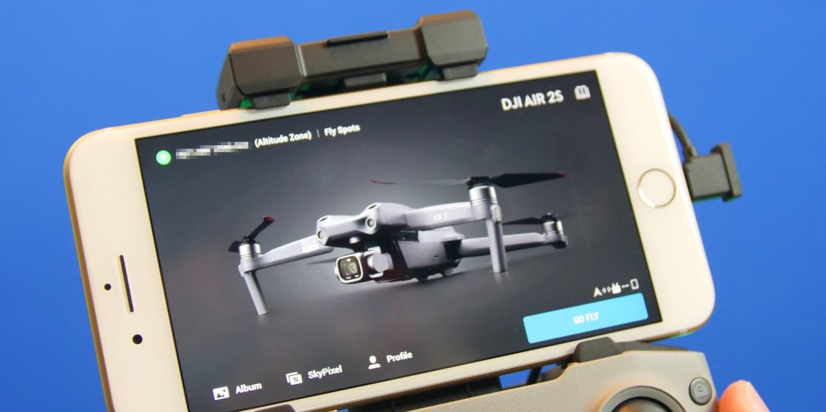
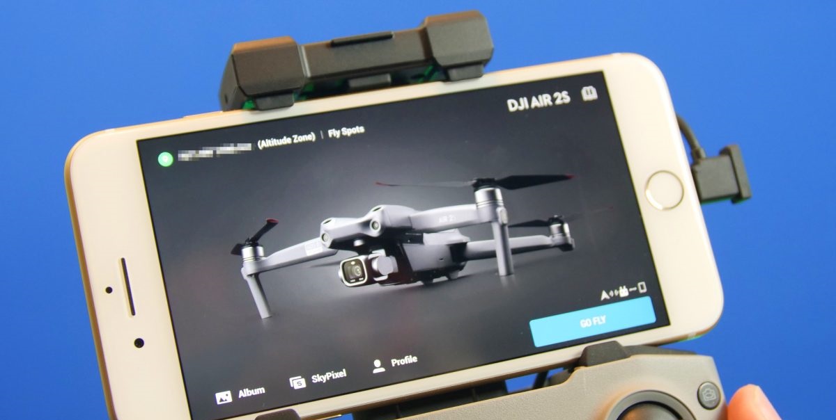
One of the standout features of DroneDeploy is its compatibility with a wide range of drones. Whether you own a DJI, Yuneec, or other popular drone models, you can seamlessly integrate your device with DroneDeploy and start capturing data immediately.
Furthermore, DroneDeploy provides a cloud-based platform that allows users to safely store and access their aerial data from anywhere. This means that you can review, analyze, and collaborate on your maps and data with ease, without the need for complex software installations.
DroneDeploy also offers integrations with popular software platforms such as Esri, Autodesk, and Slack. These integrations enable seamless data transfer and collaboration, ensuring that your team has access to the most up-to-date information for informed decision-making.
With a strong focus on user experience and continuous improvement, DroneDeploy regularly updates its platform with new features and enhancements. This ensures that users have access to the latest technologies and can maximize the benefits of drone mapping in their respective industries.
Now that we have uncovered what DroneDeploy is and the key features it offers, let’s explore the benefits of utilizing this comprehensive drone mapping software in various industries.
Key features of DroneDeploy
DroneDeploy is an advanced drone mapping software that offers a range of powerful features designed to streamline the aerial mapping workflow and provide users with accurate and actionable data. Let’s explore some of the key features that set DroneDeploy apart:
- Flight planning: DroneDeploy provides an intuitive flight planning interface that allows users to plan their missions with ease. Users can define the area to be surveyed, set flight parameters, and even automate the entire flight process.
- Real-time mapping: With DroneDeploy, users can see a live map of the area being surveyed as the drone captures images. This real-time mapping feature ensures that the data being captured is accurate and can be verified on the spot.
- Automated image capture: The software automates the process of capturing images by creating a flight path for the drone to follow. This ensures consistent image overlap and optimal coverage, resulting in high-quality maps and models.
- Advanced photogrammetry: DroneDeploy’s advanced algorithms analyze the collected images and accurately stitch them together to create seamless and detailed maps, 3D models, and orthomosaics.
- Data analysis and measurement tools: DroneDeploy offers a suite of tools for analyzing and measuring data obtained from the aerial surveys. Users can measure distances, volumes, and areas directly on the map, generating accurate and valuable insights.
- Real-time sharing and collaboration: The cloud-based platform enables users to securely store and share their maps, models, and data in real-time. This facilitates seamless collaboration among team members and stakeholders, improving communication and decision-making processes.
- Integration with other software: DroneDeploy seamlessly integrates with popular software platforms such as Esri, Autodesk, and Slack, allowing for easy data transfer and collaboration. This ensures that users can incorporate their aerial data into existing workflows and maximize the benefits of the software.
- Mobile app: With the DroneDeploy mobile app, users can control their drones, plan missions, and monitor flights directly from their mobile devices. This flexibility allows for increased efficiency and accessibility in the field.
The combination of these features makes DroneDeploy a powerful tool for professionals in industries such as agriculture, construction, mining, and environmental monitoring. Whether you are capturing aerial imagery for inspection purposes or generating accurate topographic maps, DroneDeploy provides the tools and functionality to streamline your workflow and deliver accurate results.
In the next section, we will explore the benefits of using DroneDeploy and how it can positively impact your specific industry.
Benefits of using DroneDeploy
Utilizing DroneDeploy as your drone mapping software offers a multitude of benefits across various industries. Let’s explore some of the key advantages:
- Improved safety and efficiency: Using drones equipped with DroneDeploy reduces the need for manual inspections and surveys, minimizing the risk of accidents and improving overall safety. The automated flight planning and data capture process also saves time and increases operational efficiency.
- Accurate and detailed data: DroneDeploy’s advanced photogrammetry algorithms generate highly accurate maps, 3D models, and orthomosaics. This detailed data provides insights into terrain, structures, and other features, enabling better decision-making and planning.
- Cost savings: By automating the aerial mapping process, DroneDeploy reduces the need for expensive equipment and manual labor. This ultimately leads to cost savings compared to traditional surveying methods.
- Increased productivity: With the ability to cover large areas in a short time, DroneDeploy enhances productivity. The cloud-based platform allows for real-time analysis and collaboration, enabling quicker decision-making and faster project turnaround.
- Better resource management: By capturing accurate data on crop health, construction progress, or infrastructure conditions, DroneDeploy helps optimize resource allocation. This leads to improved planning and more efficient use of manpower, equipment, and materials.
- Enhanced visualization and communication: The 3D models and maps generated by DroneDeploy offer a visually immersive and intuitive representation of the surveyed area. This aids in effectively communicating project progress, findings, and plans to stakeholders.
- Environmental monitoring: DroneDeploy facilitates environmental monitoring by providing aerial data on deforestation, erosion, land degradation, and other ecological changes. This information helps in implementing timely and targeted conservation efforts.
- Rapid response in emergencies: Drones equipped with DroneDeploy can be deployed quickly during emergency situations for search and rescue operations, damage assessments, and incident mapping. The real-time data can assist response teams in making informed decisions.
- Competitive advantage: Using advanced drone mapping technology like DroneDeploy sets businesses apart from their competitors. The ability to deliver high-quality data, quick turnaround times, and efficient workflows positions companies as industry leaders.
These are just a few of the many benefits that DroneDeploy offers. Whether you are in agriculture, construction, environmental management, or any other industry that requires accurate and efficient data collection, DroneDeploy provides the tools and functionality to elevate your operations.
Now that we have highlighted the benefits of using DroneDeploy, let’s explore how to use this powerful software and the steps involved in capturing and analyzing aerial data.
How to use DroneDeploy?
Using DroneDeploy to capture and analyze aerial data is a straightforward process that can be achieved in a few simple steps. Here’s a guide on how to effectively utilize this powerful drone mapping software:
- Plan your mission: Begin by planning your flight mission using the DroneDeploy platform. Define the area you want to survey, set the desired altitude and image overlap, and select any specific flight parameters.
- Pre-flight checks: Before launching your drone, ensure that all pre-flight checks are complete. Check the battery level, GPS signal strength, and inspect the drone for any physical damages or issues.
- Launch the drone: With the flight plan ready and pre-flight checks done, launch your drone and allow it to ascend to the designated altitude and position.
- Achieve full coverage: Ensure that the drone captures images that fully cover the targeted area. Maintain a consistent speed and altitude throughout the flight to achieve optimal image overlap and accuracy.
- Monitor flight progress: Use the DroneDeploy mobile app or real-time mapping feature to monitor the flight progress and ensure that the data being captured aligns with your desired outcomes.
- Process the data: Once the flight is complete, download the images from the drone and upload them to the DroneDeploy platform. The software will automatically stitch together the images and process the data to generate maps, models, and orthomosaics.
- Analyze and measure: Utilize DroneDeploy’s suite of analysis tools to measure distances, volumes, areas, and extract valuable insights from the generated maps. This can help with decision-making, planning, and resource management.
- Share and collaborate: Leverage the cloud-based platform to securely store and share your data with team members or stakeholders. This allows for collaborative discussions, remote access, and real-time updates.
- Implement action plans: Use the information and insights gained from DroneDeploy to implement action plans, make informed decisions, and drive positive outcomes in your projects or business operations.
Remember to always adhere to local regulations and airspace restrictions when operating your drone. Additionally, regularly update your DroneDeploy software to access the latest features and improvements.
By following these steps and utilizing the robust features of DroneDeploy, you can unlock the full potential of aerial data collection and streamline your mapping and analysis processes.
Now, let’s dive into some real-life case studies showcasing the application of DroneDeploy across different industries.
Case Studies of DroneDeploy in Action
DroneDeploy has been successfully implemented in a wide range of industries, revolutionizing processes and delivering valuable insights. Let’s explore a few real-life case studies that demonstrate the effectiveness of DroneDeploy in action:
Agriculture:
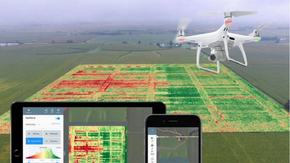
In the agricultural sector, DroneDeploy has proven to be a game-changer for crop monitoring and management. Farmers can now easily capture aerial imagery of their fields and use DroneDeploy’s analysis tools to monitor crop health, identify areas of stress, and optimize irrigation and fertilizer applications. By accurately mapping the entire farm, farmers can target specific areas for intervention and maximize crop yields, leading to increased productivity and cost savings.
Construction:
In the construction industry, DroneDeploy is being used to improve efficiency and enhance project documentation. Construction companies can capture aerial images and create detailed map overlays, aiding in site inspections, progress tracking, and design verification. Builders can measure distances, volumes, and areas directly from the maps, ensuring accurate estimations and reducing errors. This data-driven approach enables better communication between project stakeholders and streamlines construction processes, ultimately resulting in faster project completion and improved client satisfaction.
Mining:
DroneDeploy is playing a vital role in revolutionizing the mining industry. By capturing high-resolution aerial images of mining sites, companies can conduct stockpile volumetric analysis, track extraction progress, and monitor environmental impact. The ability to generate accurate 3D models and orthomosaics aids in mine planning and ensures compliance with regulatory requirements. Drones equipped with DroneDeploy have helped mining businesses optimize their operations, reduce costs, and minimize environmental impact.
Environmental Monitoring:
In the field of environmental monitoring and conservation, DroneDeploy is empowering researchers and conservationists to gather critical data more efficiently. By using drones to capture aerial imagery and thermal imaging, scientists can monitor ecosystems, wildlife habitats, and protected areas. This data provides valuable insight into changes in vegetation, wildlife populations, and potential threats. DroneDeploy’s mapping and analysis capabilities enable smarter and more effective decision-making when it comes to biodiversity conservation and environmental management.
These case studies highlight just a few of the many applications of DroneDeploy across various industries. The software’s ease of use, accuracy, and data analysis capabilities have transformed the way businesses approach mapping, analysis, and decision-making processes. As technology continues to advance, the potential for DroneDeploy to drive innovation and optimization in countless industries is limitless.
Now, let’s explore how DroneDeploy stacks up against other drone mapping software options.
Comparison with Other Drone Mapping Software
When it comes to drone mapping software, there are several options available in the market. Let’s compare DroneDeploy with other popular solutions to understand its unique features and advantages:
1. Pix4D
Pix4D is a well-known drone mapping software that offers similar capabilities to DroneDeploy. Both platforms provide advanced photogrammetry algorithms for accurate mapping and data analysis. However, DroneDeploy’s user-friendly interface and intuitive flight planning tools make it more accessible to both beginners and experienced users. Additionally, DroneDeploy’s cloud-based platform allows for seamless collaboration and real-time map updates, enhancing team efficiency and communication.
2. PrecisionHawk
PrecisionHawk is another notable drone mapping software that focuses on industrial applications. While both DroneDeploy and PrecisionHawk offer powerful analysis tools and seamless integration with other software platforms, DroneDeploy stands out with its ease of use and comprehensive subscription plans. DroneDeploy’s pricing structure provides more flexibility and options for users with varying needs, making it a more cost-effective solution for businesses of all sizes.
3. Maps Made Easy
Maps Made Easy is a simpler and more affordable option for basic drone mapping needs. It offers limited features compared to DroneDeploy’s comprehensive suite of tools and functionalities. While Maps Made Easy may suffice for hobbyists or individuals with minimal requirements, DroneDeploy’s advanced capabilities and ease of use make it the preferred choice for professionals and businesses looking for accurate and detailed mapping results.
4. Agisoft Metashape
Agisoft Metashape is a powerful photogrammetry software widely used in the mapping industry. It offers extensive features for processing large datasets and producing high-quality 3D models. However, its complex interface and steeper learning curve may deter users who are new to drone mapping. DroneDeploy’s user-friendly interface and intuitive workflows make it more accessible and suitable for both beginners and experienced users.
While other drone mapping software options provide similar functionalities to DroneDeploy, its ease of use, comprehensive features, and flexible pricing structure set it apart from the competition. Whether you are a professional pilot, mapping expert, or just starting your drone mapping journey, DroneDeploy offers a powerful and accessible solution to meet your needs.
Now, let’s explore the pricing and subscription plans offered by DroneDeploy.
Pricing and Subscription Plans
DroneDeploy offers flexible pricing and subscription plans to cater to the diverse needs of its users. Let’s take a closer look at the options available:
1. Free Plan
DroneDeploy’s Free Plan provides basic mapping functionality for individuals and hobbyists. With this plan, users can access limited features, including mapping and 3D modeling capabilities, up to 5 maps per month, and 30-day data storage. The Free Plan serves as an excellent starting point to explore the software’s capabilities before upgrading to more robust plans.
2. Professional Plan
The Professional Plan is designed for small businesses and individuals who require advanced mapping features. Priced affordably, this plan offers unlimited maps, 3D models, and data storage, along with the ability to measure distances, areas, and volumes accurately. Additionally, users can benefit from professional support, orthomosaic exports, and integrations with other software platforms.
3. Business Plan
The Business Plan is suitable for medium to large organizations with more extensive mapping needs. In addition to the features offered in the Professional Plan, the Business Plan provides advanced analytics, custom branding, and priority support. It also offers enhanced collaboration and data sharing capabilities, allowing for seamless communication and project management among team members.
4. Enterprise Plan
The Enterprise Plan provides a scalable and customizable solution for large enterprises and organizations with unique requirements. This plan offers all the features of the Business Plan, along with enterprise-level support, personalized training, dedicated account management, and additional security and privacy features. The Enterprise Plan allows businesses to tailor DroneDeploy to their specific needs and scale their operations effectively.
For an accurate and up-to-date breakdown of the pricing for each plan, it is recommended to visit DroneDeploy’s website or contact their sales team directly. The pricing of each plan may vary based on the specific requirements and scale of your operations.
DroneDeploy also offers add-ons and integrations, such as enhanced elevation tools and integrations with other software platforms, to further enhance the functionality and capabilities of the software.
Now that we have explored the pricing and subscription plans, let’s address some frequently asked questions about DroneDeploy.
Frequently Asked Questions about DroneDeploy
As a popular drone mapping software, DroneDeploy often raises questions among users. Here are some frequently asked questions about DroneDeploy:
1. Is DroneDeploy compatible with all drone models?
DroneDeploy is compatible with a wide range of popular drone models, including DJI, Yuneec, and other leading manufacturers. The software provides seamless integration, allowing users to connect their drones and leverage the full potential of DroneDeploy’s mapping and analysis capabilities.
2. Can I use DroneDeploy offline or in areas with no internet connectivity?
DroneDeploy is a cloud-based platform, and therefore, it requires an internet connection to access most of its features. However, users can plan flights and capture images offline using the DroneDeploy mobile app and sync their data to the cloud when internet connectivity is available.
3. Can I export the maps and data generated by DroneDeploy?
Yes, DroneDeploy allows users to export their maps, 3D models, and orthomosaics in various formats, such as GeoTIFF, OBJ, and LAS. This enables users to further analyze the data in third-party software or share it with stakeholders who may not have access to the DroneDeploy platform.
4. Does DroneDeploy offer support and training?
DroneDeploy offers comprehensive support through various channels, including email, chat, and a dedicated support center. Users can also access a resources library and community forum to find answers to common questions and connect with other DroneDeploy users. Additionally, DroneDeploy provides training materials, webinars, and personalized training sessions to help users maximize the software’s capabilities.
5. Is my data safe and secure on the DroneDeploy platform?
DroneDeploy is committed to ensuring the security and privacy of user data. The platform employs encryption and industry-standard security measures to protect data during transmission and storage. Additionally, data uploaded to DroneDeploy is owned by the user, and the platform implements strict access controls to ensure only authorized individuals can view or modify the data.
6. Can I integrate DroneDeploy with other software platforms?
Yes, DroneDeploy offers integrations with popular software platforms such as Esri, Autodesk, and Slack. These integrations allow users to seamlessly transfer data between platforms and streamline their workflows. Users can leverage their existing software stack and incorporate DroneDeploy data into their existing workflows easily.
If you have more specific or detailed inquiries, it’s recommended to reach out to the DroneDeploy support team directly for personalized assistance.
Now that we have addressed some frequently asked questions, let’s conclude our exploration of DroneDeploy.
Conclusion
DroneDeploy has emerged as a leading drone mapping software, revolutionizing the way industries capture, analyze, and utilize aerial data. With its user-friendly interface, advanced photogrammetry algorithms, and powerful analysis tools, DroneDeploy empowers professionals and enthusiasts alike to easily create accurate maps, 3D models, and orthomosaics.
Through case studies and comparisons, we have seen how DroneDeploy has made significant impacts across various industries. From agriculture to construction, mining to environmental monitoring, DroneDeploy has proven to be a versatile tool, enhancing safety, efficiency, and productivity.
With its flexible pricing and subscription plans, DroneDeploy caters to the needs of individuals, small businesses, and large enterprises alike. Whether you are new to drone mapping or an experienced professional, DroneDeploy offers the right features and functionalities to meet your specific requirements.
As technology continues to advance, DroneDeploy remains at the forefront, constantly evolving and innovating to provide the most comprehensive mapping and analysis capabilities. With its seamless integrations, cloud-based collaboration, and commitment to user support, DroneDeploy is an ideal choice for businesses and individuals looking to harness the power of aerial data.
So, whether you’re a farmer monitoring crop health, a construction manager tracking project progress, or an environmentalist studying ecological changes, DroneDeploy can elevate your operations and contribute to more informed decision-making.
Explore the possibilities with DroneDeploy and unlock the true potential of aerial mapping!