Introduction
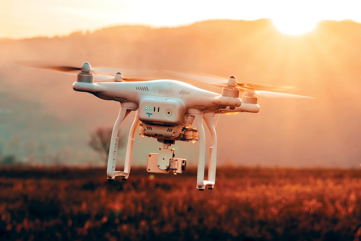
Drones, also known as unmanned aerial vehicles (UAVs), have become increasingly popular in recent years. These versatile flying machines have revolutionized various industries by providing unique and efficient solutions to complex problems. Drone technology has evolved rapidly, making it accessible and affordable for both professional and recreational use.
The applications of drones are vast and diverse, ranging from aerial photography to delivery services. With their ability to maneuver in the air and capture high-quality images and videos, drones have transformed the way we capture and document our surroundings.
While drones were initially associated with military use, today they are commonly used in multiple fields, including photography, film production, agriculture, search and rescue operations, infrastructure inspections, and many more.
This article aims to explore the various uses and benefits of drones, highlighting their contributions to different industries. From capturing stunning aerial shots to performing critical tasks, drones have truly become indispensable in our modern world.
So, let’s dive into the exciting world of drones and discover the amazing things they can do.
Aerial Photography
Aerial photography is one of the primary uses of drones in the creative industry. Drones equipped with high-resolution cameras have revolutionized the art of photography by providing a unique perspective from the sky. Photographers can now capture breathtaking shots that were once only accessible from helicopters or airplanes.
Drones offer photographers the ability to capture stunning aerial images and videos of landscapes, cityscapes, events, and more. The maneuverability and stability of drones allow for creative framing and dynamic shots that were previously difficult or impossible to achieve. This has opened up new possibilities for photographers to express their creativity and capture scenes from unique angles.
One of the main advantages of aerial photography using drones is its cost-effectiveness. It eliminates the need for hiring helicopters or planes, reducing expenses significantly. Additionally, drones can be operated remotely, allowing photographers to capture shots from a safe location.
The applications of aerial photography using drones are vast. Real estate agents can utilize drone photography to showcase properties from a bird’s-eye view, providing potential buyers with a comprehensive view of the property and its surroundings. Event photographers can capture memorable moments from above, adding a different perspective to their work.
Furthermore, drones equipped with advanced imaging technology, such as thermal cameras, are used in environmental studies to monitor wildlife, track migration patterns, and assess changes in ecosystems. These aerial shots provide valuable data for conservation efforts and research.
Overall, aerial photography using drones has transformed the art of photography and expanded the creative possibilities for professionals and enthusiasts alike. The ability to capture unique perspectives and stunning visuals from the sky has elevated the field of photography, creating remarkable and awe-inspiring imagery.
Filmmaking and Cinematography
Drones have revolutionized the world of filmmaking and cinematography, providing filmmakers with unprecedented opportunities to capture breathtaking aerial shots and create visually stunning scenes. With their ability to fly and maneuver in unique ways, drones have transformed the way films are made.
Traditionally, capturing aerial shots for films required expensive equipment such as helicopters or cranes, which often limited the creativity and budget of filmmakers. However, drones equipped with high-resolution cameras and stabilization technology have made it far more accessible and affordable to capture aerial footage.
Using drones, filmmakers can capture dynamic and sweeping shots that were once only possible with extensive resources. The ability to fly at varying heights and angles allows for creative and dramatic storytelling. Aerial shots can provide the audience with a broader perspective, immersing them in the cinematic experience.
Drone technology has also facilitated the use of tracking shots and continuous camera movement, adding a dynamic element to film sequences. Filmmakers can now capture seamless and fluid shots that enhance the visual storytelling and create a more immersive viewing experience.
In addition to traditional filmmaking, drones have also made a significant impact on the world of cinematography. Aerial shots captured by drones can be utilized in commercials, music videos, documentaries, and even live broadcasts. Drones can capture stunning visuals that elevate the production value and convey the desired message.
Furthermore, drones equipped with advanced camera features, such as 4K resolution or slow-motion capabilities, enable filmmakers and cinematographers to push the boundaries of visual storytelling. These versatile tools allow for creative experimentation and bring a touch of innovation to the filmmaking process.
Overall, the utilization of drones in filmmaking and cinematography has expanded creative possibilities and enhanced the visual storytelling in the entertainment industry. With their ability to capture breathtaking aerial shots and add a unique perspective to scenes, drones have become an invaluable tool for filmmakers and cinematographers worldwide.
Inspection and Surveillance
Drones have become integral in inspection and surveillance activities across various industries. Their maneuverability, versatility, and ability to access difficult-to-reach areas have made them invaluable tools for inspecting and monitoring critical infrastructure, ensuring safety, and enhancing security.
In industries like construction and infrastructure, drones are used for inspecting buildings, bridges, pipelines, and power lines. They can easily navigate through complex structures, capturing high-resolution images and videos of potential problem areas, such as cracks, corrosion, or structural damage. This allows engineers and inspectors to identify issues quickly and efficiently, enabling timely repairs and maintenance.
Drones also play a crucial role in surveillance tasks, assisting law enforcement agencies and security personnel. Equipped with cameras and thermal imaging technology, drones can monitor large areas and provide real-time footage to aid in surveillance operations. They can be deployed to monitor crowd movements, conduct search operations, and assist in securing public events.
In addition, drones are utilized for border patrolling, helping authorities to monitor boundaries and detect any suspicious activities. With their aerial capabilities, drones offer a comprehensive view of the border regions, enabling border control agencies to enhance their surveillance and respond to potential threats in a more effective manner.
Moreover, drones are used in disaster management and emergency response operations. In situations like natural disasters or hazardous incidents, drones can be deployed to assess the extent of damage, locate survivors, and determine the overall situation in remote or inaccessible areas. This information aids in planning rescue and relief efforts, ensuring a timely and efficient response.
In summary, drones have become indispensable in inspection and surveillance activities. Their ability to access challenging areas and provide real-time footage has transformed the way infrastructure is inspected and secured. With their aerial capabilities, drones play a crucial role in enhancing safety, improving security, and facilitating efficient emergency response operations.
Search and Rescue Operations
When it comes to search and rescue operations, time is of the essence, and every second counts. Drones have emerged as valuable tools in these critical operations, offering speed, agility, and aerial capabilities that aid in locating missing persons, providing assistance in natural disasters, and ensuring the safety of both rescuers and those in need.
One of the primary advantages of using drones in search and rescue operations is their ability to access areas that may be difficult or dangerous for humans to reach. Drones equipped with thermal cameras and advanced sensors can quickly scan vast areas, increasing the chances of detecting individuals who may be trapped, injured, or lost.
In scenarios such as natural disasters, drones play a vital role in assessing the scope of the disaster and identifying areas that require immediate attention. They enable rescue teams to gather real-time information about the affected areas, helping them deploy resources strategically and efficiently.
Furthermore, drones equipped with loudspeakers or communication systems can provide a means of direct communication with individuals in distress. This capability allows rescuers to convey instructions, offer reassurance, and coordinate rescue efforts more effectively.
In maritime search and rescue operations, drones are extremely valuable in locating individuals in water or on remote islands. With their ability to fly over large bodies of water, drones can cover expansive search areas quicker than traditional methods, significantly increasing the chances of finding and rescuing survivors.
Thanks to their aerial capabilities, drones have also proven effective in searching for missing or lost hikers in rugged terrains or dense forests. They can survey vast areas and capture high-quality images, assisting search teams in identifying possible routes and narrowing down search areas, which expedites the overall search and rescue process.
Overall, drones have become an indispensable asset in search and rescue operations. Their ability to access difficult terrains, swiftly cover vast areas, and provide real-time information significantly enhances the efficiency and effectiveness of rescue efforts. With the aid of drones, rescuers can save lives and bring hope to those in need.
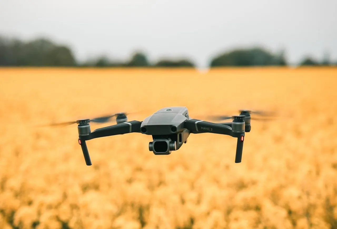
Agriculture and Crop Monitoring
Drones have revolutionized the agricultural industry by providing farmers with a powerful tool for crop monitoring and management. With their aerial capabilities and advanced sensors, drones have transformed the way farmers maintain and optimize their crops.
One of the primary uses of drones in agriculture is crop monitoring. Drones equipped with cameras and multispectral sensors can capture high-resolution images and collect valuable data about the health and condition of crops. This data includes information on nutrient levels, moisture content, pest infestations, and overall crop growth.
By analyzing the collected data, farmers can make informed decisions about fertilization, irrigation, and pest control measures. Drones enable farmers to identify potential issues in their crops early on, allowing for proactive measures to be taken, ultimately improving crop yields and reducing losses.
With detailed aerial imagery of their fields, farmers gain a comprehensive view of their entire crop, which may be difficult to obtain from ground-level observations alone. By identifying specific areas that need attention, farmers can target their resources and efforts more effectively, saving time, money, and resources in the process.
In addition, drones can be used to create precise 3D maps of farmland, providing farmers with accurate topographical information. This data aids in land planning, irrigation management, and drainage system design. Farmers can optimize the use of their land by understanding its contours, identifying potential water retention issues, and maximizing crop productivity.
Furthermore, drones have been instrumental in the implementation of precision agriculture techniques. By utilizing GPS and advanced imaging technology, drones can provide precise and localized application of fertilizers, pesticides, and herbicides. This targeted approach minimizes the use of chemicals, reduces environmental impact, and ensures optimal distribution for maximum crop health.
Overall, drones have become an essential tool for farmers in crop monitoring and management. By providing valuable data on crop health, offering detailed aerial imagery, and aiding in precision agriculture techniques, drones have helped optimize farming practices and contribute to increased productivity and sustainability in the agricultural industry.
Wildlife Monitoring and Conservation
Drones have emerged as valuable tools in wildlife monitoring and conservation efforts, providing researchers and conservationists with an innovative approach to studying and protecting various species. With their aerial capabilities, drones have revolutionized wildlife research, habitat monitoring, and anti-poaching initiatives.
One of the primary benefits of using drones in wildlife monitoring is their ability to access remote and inaccessible areas. Drones equipped with high-resolution cameras and thermal imaging sensors can survey large spans of land, helping researchers identify animal populations, track migration patterns, and assess changes in habitats.
Moreover, drones enable scientists to study wildlife behavior in a non-intrusive manner. These unmanned aerial vehicles can observe animals from a safe distance, minimizing disturbance to their natural behavior. With the ability to observe species from above, drones provide a unique and comprehensive perspective on their movements, interactions, and nesting habits.
Drones also play a crucial role in combating wildlife poaching and illegal activities. By patrolling protected areas and wildlife reserves, drones can deter potential poachers and provide real-time monitoring of vulnerable species. The aerial surveillance capabilities of drones allow for immediate response to any suspicious activities, enhancing the effectiveness of anti-poaching efforts.
Additionally, drones equipped with thermal imaging technology can aid in locating and monitoring endangered species. These advanced sensors can detect body heat signatures, enabling researchers and conservationists to identify individuals or groups of animals that might require special attention or protection.
Furthermore, drones have been instrumental in mapping and monitoring endangered species’ habitats. By capturing detailed aerial imagery and data, researchers can assess the health of ecosystems, identify habitat degradation, and implement targeted conservation measures.
Overall, drones have become invaluable tools in wildlife monitoring and conservation. With their aerial capabilities, drones provide researchers and conservationists with a unique perspective on wildlife behavior, habitat monitoring, and anti-poaching activities. By leveraging drone technology, we can better understand and protect our precious natural ecosystems and the diverse species that inhabit them.
Surveying and Mapping
The use of drones in surveying and mapping has revolutionized the way professionals in various industries collect geospatial data and create accurate maps. With their aerial capabilities, drones offer a cost-effective and efficient solution for conducting surveys, monitoring land development, and creating high-resolution maps.
Traditionally, surveying and mapping involved manual measurements and labor-intensive processes. However, drones equipped with advanced imaging technology, such as photogrammetry and LiDAR, enable rapid data collection and precise mapping of various terrains and structures.
One of the primary advantages of utilizing drones in surveying and mapping is their ability to access challenging or hazardous areas. Drones can easily fly over difficult terrains, such as mountains, forests, or construction sites, capturing detailed imagery and collecting data from locations that would otherwise be difficult or unsafe for surveyors to reach.
Drones equipped with cameras or LiDAR sensors can capture high-resolution imagery, including topographic features, elevation data, and 3D models of the surveyed area. This data is then processed to create accurate and detailed maps, enabling professionals in industries like urban planning, construction, and land development to make informed decisions based on reliable data.
In the field of construction, drones aid in monitoring the progress of projects and conducting inspections. By regularly surveying construction sites, drones provide stakeholders with real-time imagery and mapping updates, helping reduce errors, improve efficiency, and ensure compliance with design specifications.
In mapping applications, drones expedite the process of creating up-to-date and accurate maps. Whether it’s mapping land for agricultural purposes, creating digital elevation models, or conducting environmental surveys, drones offer a faster and more cost-effective alternative to traditional surveying methods.
Additionally, drones can be equipped with specialized sensors, such as thermal cameras, to identify heat patterns and detect anomalies. This capability proves valuable in infrastructure inspections, as drones can identify potential issues, such as leaks or heat loss, in buildings, pipelines, or power lines.
Overall, the use of drones in surveying and mapping has transformed the geospatial industry. With their aerial capabilities, drones provide a more efficient and accurate approach to data collection, offering professionals in various fields the ability to create detailed maps, monitor projects, and ensure the successful implementation of their endeavors.
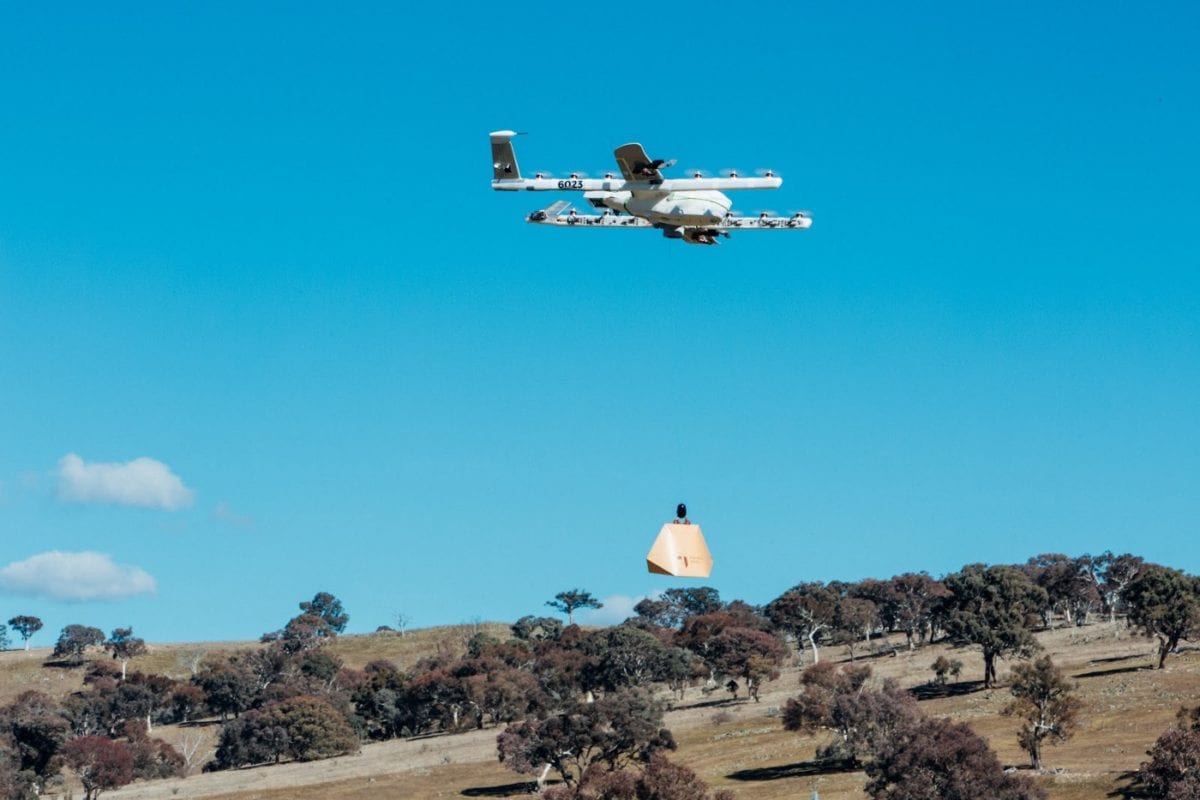
Delivery and Logistics
The use of drones in delivery and logistics has gained significant attention in recent years, promising faster, more efficient, and cost-effective transportation solutions. Drones offer a unique and innovative method of delivering goods, particularly in areas with challenging terrain or limited access to traditional transportation routes.
One of the primary advantages of using drones for delivery is their ability to bypass traffic congestion and deliver packages directly to their destinations. With efficient route planning and the ability to fly in a straight line, drones can significantly reduce delivery times compared to traditional ground transportation methods.
Delivery drones are particularly useful in remote and rural areas where transportation infrastructure may be limited or inefficient. They can easily navigate through difficult terrains, delivering essential items such as medical supplies, emergency aid, or even groceries to areas that are otherwise hard to reach.
Drones also provide valuable assistance in disaster response and relief efforts. In emergency situations, drones can swiftly deliver supplies, medicines, and equipment to affected areas, providing much-needed support to those in need. These unmanned aerial vehicles can also aid in search and rescue missions, helping locate survivors and assess the extent of damage.
In addition to delivery services, drones are increasingly being utilized in logistics operations, particularly in large warehouses and distribution centers. They can autonomously navigate within these facilities and assist in inventory management, item tracking, and optimizing warehouse operations.
Furthermore, drones have the potential to revolutionize the last-mile delivery segment. By flying directly to customers’ doorsteps, drones eliminate the need for human drivers or couriers, reducing costs and increasing delivery efficiency. This can be especially beneficial in densely populated urban areas where traffic congestion and parking limitations are common challenges.
While the use of drones in delivery and logistics is still being developed and regulated, the potential benefits are undeniable. As technology evolves and regulations adapt, we can expect to see increased adoption of drones in the transportation and logistics industry, transforming the way goods are delivered and enhancing the overall efficiency of the supply chain.
Infrastructure Inspections
Drones have become invaluable tools for conducting infrastructure inspections, offering efficient, cost-effective, and safe alternatives to traditional inspection methods. With their aerial capabilities and advanced imaging technology, drones have revolutionized the way engineers and inspectors assess the condition and integrity of various structures.
One of the primary advantages of using drones for infrastructure inspections is their ability to access hard-to-reach or hazardous areas. Drones can easily navigate through complex structures such as bridges, towers, or rooftops, capturing high-resolution imagery and collecting data from angles that would otherwise require extensive equipment or put human inspectors at risk.
Drones equipped with cameras, thermal sensors, or LiDAR technology can capture detailed images and data that provide a comprehensive understanding of the infrastructure’s condition. This information can be used to identify structural damage, corrosion, cracks, or other potential issues that may require immediate attention.
Using drones for inspections significantly reduces the time and cost associated with traditional inspection methods. Instead of erecting scaffolding or using cranes to reach specific areas, drones can swiftly and efficiently survey large structures, capturing accurate data in a fraction of the time. This leads to more timely maintenance and repair decisions, minimizing the impact on infrastructure functionality.
Moreover, drones provide real-time visual feedback during inspections, allowing engineers and inspectors to assess the structural condition immediately. Live video feeds and high-resolution imagery enable inspectors to identify anomalies and potential safety hazards while the drone is still in flight, saving time and increasing efficiency.
In addition to routine inspections, drones are also employed in disaster assessment and post-event inspections. After natural disasters such as earthquakes or hurricanes, drones can quickly and safely assess the damage to infrastructure, providing authorities with valuable information for rescue and recovery efforts.
The use of drones in infrastructure inspections is not limited to buildings and bridges. They are also utilized for monitoring power lines, pipelines, and other critical infrastructure assets. Drones equipped with thermal cameras can identify abnormal temperature patterns or leakage, prompting timely maintenance to prevent potential failures or accidents.
Overall, drones have significantly improved the efficiency and effectiveness of infrastructure inspections. By providing safe and comprehensive aerial data collection, drones help maintain the integrity, safety, and functionality of various structures, ensuring the longevity and reliability of our built environment.
Entertainment and Recreation
When it comes to entertainment and recreation, drones have opened up a world of possibilities, providing exciting and unique experiences for enthusiasts and recreational users. Drones have become increasingly popular for their ability to capture stunning aerial footage, participate in drone races, and offer immersive experiences in various forms of recreation.
Aerial photography and videography are at the forefront of drone-based entertainment. With high-resolution cameras and stabilizing technology, drones allow enthusiasts and professional photographers to capture breathtaking images and cinematic videos from unique perspectives. Whether it’s capturing landscapes, action sports, or special events, drones have revolutionized the way we document and share our adventures.
Drone racing has emerged as a thrilling new sport, combining high-speed piloting skills with cutting-edge drone technology. Racers compete in obstacle-filled courses, maneuvering their drones at incredible speeds, taking the excitement of RC racing to new heights. Drone racing events attract both participants and spectators, creating a vibrant community of drone enthusiasts.
Besides aerial photography and racing, drones have also introduced immersive experiences for recreational users. Virtual Reality (VR) and First Person View (FPV) goggles allow users to experience the thrills of flying as if they were inside the drone itself. This technology brings a new level of immersion and excitement to drone flying, making it a popular form of entertainment for both beginners and experienced pilots.
Furthermore, drones have been utilized in providing unique entertainment experiences at events and shows. LED-equipped drones can be synchronized to create captivating light shows, adding a mesmerizing visual spectacle to concerts, outdoor events, and even fireworks displays. These aerial performances wow audiences with stunning formations and choreographed sequences.
In the world of filmmaking and cinematography, drones have transformed the creative possibilities. They allow filmmakers to capture dynamic and cinematic aerial shots that were once only achievable with expensive equipment and helicopters. Drones have made it more accessible and cost-effective to create stunning visuals, enhancing the overall quality of films and videos.
Overall, drones have become an integral part of entertainment and recreational activities. With their aerial capabilities, advanced technology, and immersive experiences, drones offer thrilling opportunities for aerial photography, racing, and unique entertainment experiences. They have truly changed the way we engage in recreation and how we capture and appreciate the world around us.
Conclusion
Drones, with their aerial capabilities and advanced technology, have had a profound impact on various industries and recreational activities. They have revolutionized the way we capture images and videos, transformed filmmaking and cinematography, aided in critical tasks like search and rescue operations, and provided innovative solutions in fields such as agriculture and infrastructure inspections.
Aerial photography has taken on new dimensions with drones, allowing photographers to capture breathtaking shots from unique and creative perspectives. Filmmakers and cinematographers have embraced the possibilities offered by drones, creating visually stunning and dynamic scenes that enhance storytelling. In search and rescue operations, drones have proven invaluable in locating missing individuals and providing aid in emergency situations.
In the field of agriculture, drones have transformed the way farmers monitor and manage their crops, optimizing resource usage and improving yield. They have played a crucial role in wildlife monitoring and conservation efforts, aiding researchers in studying species behavior, habitat assessment, and anti-poaching initiatives.
Drones have also simplified surveying and mapping processes, providing accurate data and detailed maps for various purposes, from urban planning to environmental surveys. In the realm of delivery and logistics, drones offer the potential for faster and more efficient transportation, particularly in remote areas or during emergency situations.
Entertainment and recreational activities have also been transformed by drones, with aerial photography, drone racing, and immersive experiences captivating enthusiasts and creating new forms of entertainment. Whether it’s capturing breathtaking shots, participating in thrilling races, or experiencing flight through VR goggles, drones have added excitement and wonder to our leisure pursuits.
As drone technology continues to advance, new applications and opportunities will arise, further expanding their role in various industries and enhancing our daily lives. However, it is important to keep in mind the ethical and regulatory considerations that come with utilizing drones. Safety, privacy, and responsible usage should always be given paramount importance.
In conclusion, drones have proven to be versatile tools that have transformed industries, empowered professionals, and provided thrilling experiences for enthusiasts. From capturing stunning visuals to aiding in critical operations, drones have undoubtedly changed the way we perceive and interact with the world around us.