Introduction
Welcome to the exciting world of drone surveying! In recent years, technological advancements have revolutionized the way we collect data, and drone surveying has emerged as a cutting-edge method in various industries. Drones, also known as unmanned aerial vehicles (UAVs), have the ability to capture high-resolution images, collect data, and produce accurate maps with incredible precision and efficiency.
Drone surveying offers a wide range of benefits that surpass traditional surveying methods. The ability to access areas that are difficult to reach, such as rugged terrains, dense forests, or hazardous environments, makes drone surveying a valuable tool in many industries. From construction and engineering to agriculture and environmental monitoring, the applications of drone surveying are vast and versatile.
This article explores what drone surveying is, the benefits it offers, the applications it can be used for, how it works, the types of drones commonly used in surveying, and the factors to consider when using drones for surveying.
Whether you’re a seasoned professional looking to enhance your surveying capabilities or someone curious about this innovative technology, this article will provide you with a comprehensive overview of drone surveying and its potential applications.
So buckle up and prepare to soar through the skies of drone surveying, where data collection becomes more efficient, cost-effective, and accurate than ever before.
What is Drone Survey?
Drone surveying, also referred to as aerial surveying or UAV surveying, is a method of collecting data and generating accurate maps and 3D models using unmanned aerial vehicles (UAVs). These drones are equipped with high-resolution cameras, LiDAR sensors, or other specialized sensors to capture detailed information about the terrain, objects, or structures.
Unlike traditional surveying methods that involve manual measurements and ground-based equipment, drone surveying utilizes the agility and flexibility of drones to efficiently gather data from above. By flying over the desired area, the drones capture a series of images or collect point cloud data, which is then processed to create maps, topographic models, or orthomosaics.
The data collected through drone surveying can provide valuable insights into various industries. In construction and engineering projects, drone surveys can help with site planning, volume calculations, and monitoring progress. In agriculture, drones can be used to assess crop health and monitor irrigation systems. They are also employed in environmental monitoring, land management, and disaster assessment, among other applications.
One of the key advantages of drone surveying is its ability to access hard-to-reach areas. Drones can fly over terrains that are difficult or dangerous for humans to navigate, such as steep slopes, dense forests, or remote locations. This allows for comprehensive data collection and analysis, leading to more accurate and informed decision-making.
Overall, drone surveying offers a fast, cost-effective, and efficient way to collect data and generate detailed maps and models. It eliminates the need for manual measurements and significantly reduces the time and effort required for traditional surveying methods.
In the next section, we will explore the benefits of using drones for surveying and how they can enhance various industries.
Benefits of Drone Survey
Drone surveying has rapidly gained popularity across industries due to the wide array of benefits it offers. Here are some key advantages of using drones for surveying:
1. Efficiency: Drone surveying significantly reduces the time and effort required for data collection. Drones can cover large areas in a fraction of the time it takes for traditional surveying methods. This speed and efficiency allow projects to be completed faster and with higher productivity.
2. Cost-effective: Traditional surveying methods often require extensive manpower and resources. By using drones, companies can save on labor costs and equipment expenses. Drones also require minimal maintenance, which further contributes to cost savings over time.
3. Accuracy: With advanced GPS and onboard sensors, drones can capture data with exceptional accuracy. This level of precision enables the generation of highly accurate maps, models, and measurements, ultimately leading to more reliable decision-making.
4. Access to hard-to-reach areas: Drones can access areas that are difficult or dangerous for humans to reach. Whether it’s a steep slope, rugged terrain, or hazardous environments, drones can efficiently navigate these obstacles and collect data that would otherwise be inaccessible.
5. Improved safety: By eliminating the need for manual measurements in hazardous environments, drone surveying reduces the potential risks and dangers associated with traditional surveying methods. This enhances worker safety and minimizes the chances of accidents or injuries.
6. Real-time data: Drones can provide real-time data during the surveying process. This allows project managers, engineers, or field operators to monitor progress, identify potential issues, and make informed decisions on the spot.
7. Eco-friendly: Compared to traditional surveying methods that involve heavy machinery or extensive ground disturbance, drone surveying has a lower environmental impact. Drones use significantly less energy and generate fewer emissions, making them a greener option for data collection.
The benefits of drone surveying extend to various industries, including construction, engineering, agriculture, environmental monitoring, and more. By harnessing the power of drone technology, companies can enjoy increased efficiency, cost savings, improved accuracy, and safer operations.
In the next section, we will explore the wide range of applications where drone surveying is being used to transform these industries.
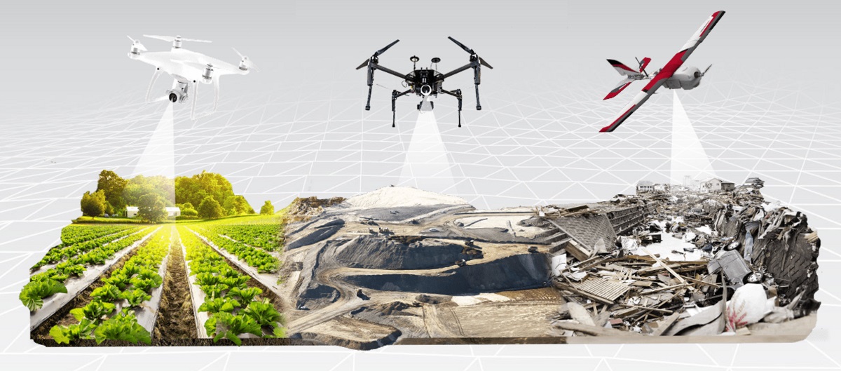
Applications of Drone Survey
Drone surveying has a wide range of applications across different industries. Here are some of the key areas where drone surveying is being utilized:
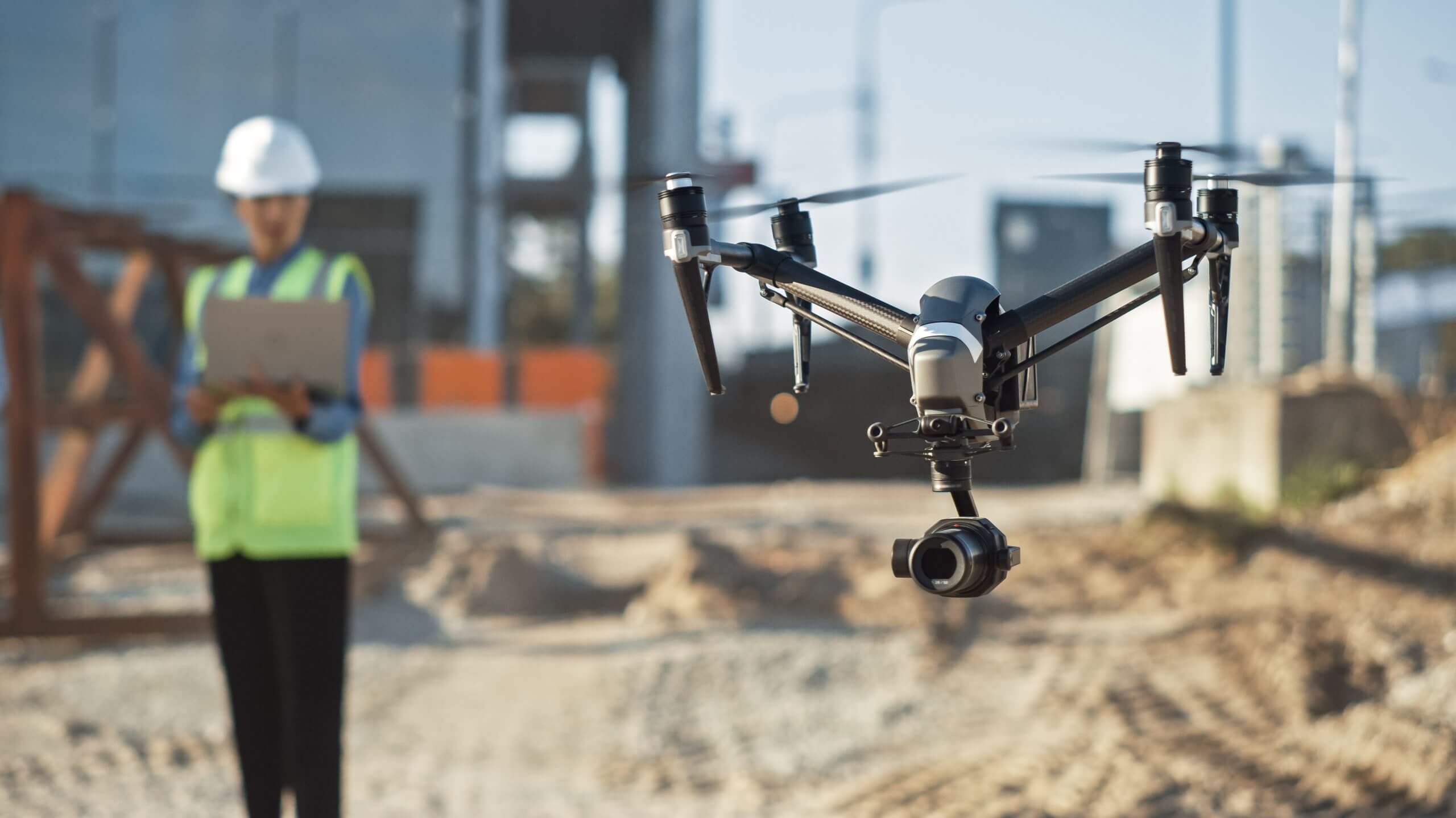
1. Construction and Engineering: Drones are extensively used in the construction and engineering sectors for site surveys, progress monitoring, and 3D modeling. They provide accurate aerial data that helps in project planning, detecting potential issues, and improving overall construction efficiency.
2. Agriculture: In agriculture, drones are used for crop monitoring, yield estimation, and precision agriculture. By collecting aerial data, drones can assess crop health, detect irrigation issues, and optimize the application of fertilizers and pesticides.
3. Environmental Monitoring: Drones play a crucial role in environmental monitoring, such as assessing wildlife habitats, monitoring deforestation, and detecting changes in ecosystems. They provide a cost-effective and non-intrusive way to gather data on environmental conditions and support conservation efforts.
4. Infrastructure Inspection: Drones offer a safer and more efficient alternative to traditional methods of infrastructure inspection. They can inspect bridges, power lines, pipelines, and buildings, providing detailed visual data to identify structural issues and potential hazards.
5. Mining and Quarrying: Drone surveying is widely used in mining and quarrying operations for stockpile monitoring, slope stability assessment, and volumetric measurements. Drones enable quick and accurate analysis of large mining areas, optimizing resource allocation and monitoring excavation activities.
6. Disaster Assessment and Management: Drones have proven invaluable in disaster management by providing rapid damage assessments in areas affected by natural disasters. They help emergency responders identify areas of concern, assess structural stability, and plan efficient rescue and recovery operations.
7. Land Surveying and Mapping: Drones have revolutionized land surveying and mapping processes. They can quickly generate detailed topographic maps, orthomosaics, and 3D models of large areas, providing precise measurements and facilitating land development and urban planning.
8. Film and Photography: With their ability to capture stunning aerial footage, drones have transformed the film and photography industry. They are widely used in filmmaking, real estate photography, event coverage, and tourism marketing to capture unique and captivating perspectives.
These are just a few examples of the diverse applications of drone surveying. With continuous advancements in drone technology and data processing software, new applications are being discovered and explored in various industries.
In the next section, we will delve into how drone surveying works and the technology behind it.
How does Drone Survey work?
Drone surveying involves a combination of hardware, software, and skilled operators working together to collect and process data. Here is a general overview of how drone surveying works:
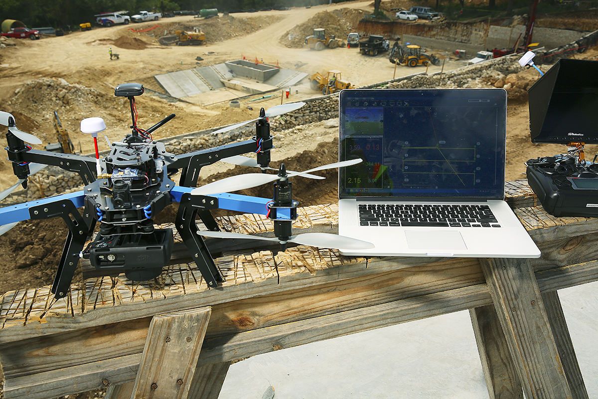
1. Flight Planning: The surveying process begins with carefully planning the drone’s flight path. Operators use specialized software to define the survey area, set the desired altitude, and establish the necessary overlap between images. This ensures complete coverage and sufficient data for accurate mapping.
2. Data Collection: Once the flight plan is finalized, the drone is launched and begins capturing data. Equipped with high-resolution cameras, LiDAR sensors, or other specialized sensors, the drone captures images or collects point cloud data as it flies over the survey area. Sensors can capture information about the terrain, objects, or structures.
3. Image Stitching and Data Processing: After the flight, the collected data is processed using specialized software. This typically involves image stitching to create high-resolution orthomosaics or point cloud processing to create accurate 3D models of the surveyed area. Advanced algorithms are used to align images, eliminate distortions, and reconstruct the survey area.
4. Mapping and Analysis: The processed data is then used to generate maps, topographic models, or other desired outputs. These outputs provide detailed information about the surveyed area, such as elevation contours, vegetation analysis, or infrastructure details. The data can also be integrated into GIS platforms for further analysis and decision-making.
5. Reporting: The final step involves presenting the generated outputs in a clear and concise manner. Surveyors analyze and interpret the data to extract meaningful insights and create reports that can be shared with clients, stakeholders, or project teams.
It is important to note that successful drone surveying requires trained and experienced operators who are knowledgeable about flight regulations, data processing techniques, and industry-specific requirements. Proper data validation and quality control measures are also implemented to ensure accurate and reliable results.
With advancements in technology, some drones are now equipped with real-time data transmission capabilities. This means that data can be processed and analyzed on-site, allowing operators to make immediate decisions and adjustments to the surveying process when necessary.
In the next section, we will explore the different types of drones commonly used in surveying and their specific capabilities.
Types of Drones Used in Surveying
When it comes to drone surveying, different types of drones are used depending on the specific surveying needs and requirements. Here are some of the common types of drones used in surveying:
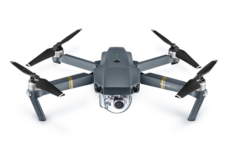
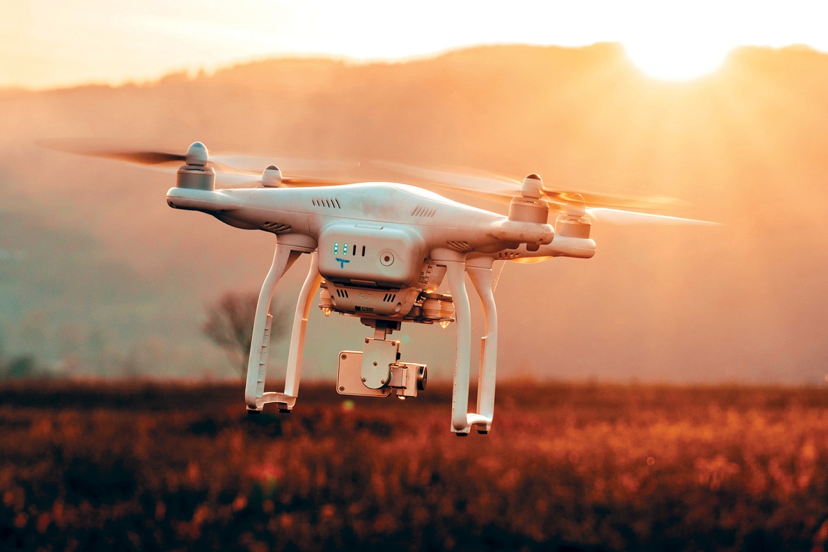
1. Quadcopters: Quadcopters, or quadrotor drones, are one of the most popular types of drones used in surveying. They are equipped with four rotors positioned at each corner, which provide stability and maneuverability. Quadcopters are versatile and capable of capturing high-resolution images and videos, making them suitable for a wide range of surveying applications.
2. Fixed-wing Drones: Fixed-wing drones have a more traditional airplane-like design, with fixed wings and a propeller at the front. Unlike quadcopters, fixed-wing drones are propelled by the forward motion generated by their wings. This design allows them to cover larger areas in a single flight, making them ideal for large-scale surveys and mapping projects.
3. Multi-rotor Drones: Multi-rotor drones are similar to quadcopters but have more than four rotors, usually six or eight. The additional rotors provide increased stability, payload capacity, and longer flight times. Multi-rotor drones are commonly used for tasks that require heavier sensors, such as LiDAR scanners or thermal cameras.
4. Hybrid Drones: Hybrid drones combine the features of both fixed-wing and multi-rotor drones. They have the ability to take off and land vertically, like multi-rotor drones, but can transition into a fixed-wing flight mode for longer endurance and extended coverage. Hybrid drones are suitable for projects that require both vertical takeoff and landing capabilities and efficient long-distance surveys.
5. Lidar Drones: Lidar drones are specialized drones equipped with Light Detection and Ranging (LiDAR) sensors. These sensors emit laser beams and measure the time it takes for the laser pulses to bounce back, providing highly accurate 3D point cloud data. Lidar drones are commonly used in topographic surveys, mapping, and infrastructure inspections.
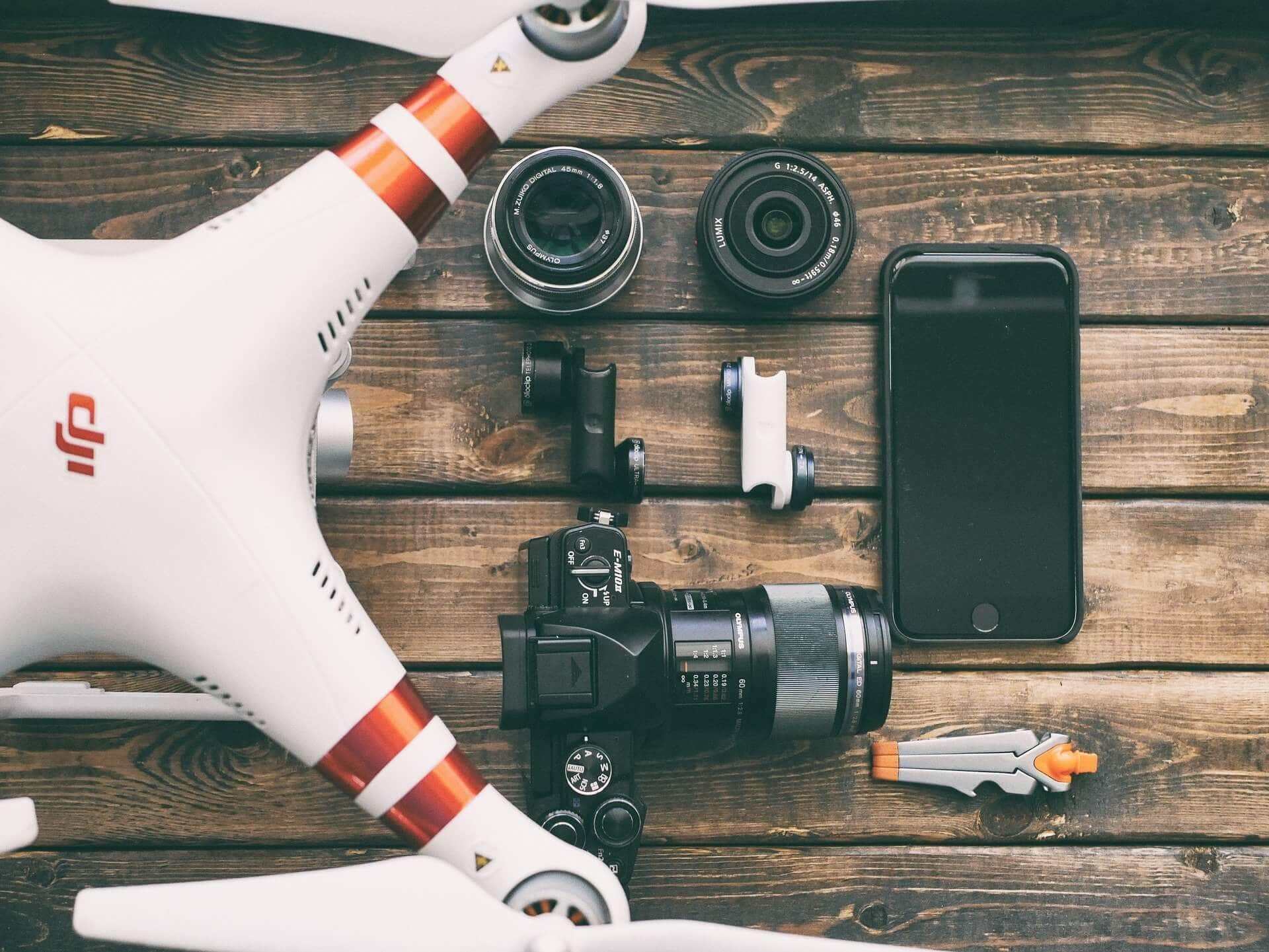
6. Photogrammetry Drones: Photogrammetry drones are specifically designed for capturing high-resolution aerial imagery. They are equipped with advanced cameras and imaging systems that can capture detailed and overlapping images. These images are then used in the photogrammetry process, where algorithms stitch them together to create orthomosaics and 3D models.
It’s worth noting that the capabilities and specifications of drones used in surveying can vary significantly depending on the brand, model, and additional features. Some drones may have longer flight times, higher payload capacities, or specialized sensor compatibility. It’s important to select the drone that best suits the specific surveying requirements.
In the next section, we will discuss important factors to consider when using drones for surveying to ensure successful and efficient operations.
Factors to Consider When Using Drones for Surveying
Utilizing drones for surveying can greatly enhance data collection and mapping capabilities. However, there are several important factors to consider to ensure successful and efficient operations. Here are some key factors to keep in mind:
1. Regulations and Permissions: Before using drones for surveying, it is essential to familiarize yourself with local regulations and obtain the necessary permissions. Different regions may have specific rules regarding drone operations, including restrictions on flight altitudes, flight paths, and operating near airports or sensitive areas. Adhering to these regulations is crucial to ensure legal and safe drone surveying.
2. Flight Planning and Risk Assessment: Effective flight planning is essential for successful drone surveying. Assess the survey area and identify potential risks, such as nearby obstacles, power lines, or airspace restrictions. Plan the flight path accordingly and ensure that the drone’s batteries and flight time are sufficient to cover the intended area. Conducting a risk assessment beforehand helps mitigate potential hazards and ensures the safety of the operation.
3. Drone Equipment Selection: Selecting the right drone and equipment for the surveying task is crucial. Consider factors such as flight capabilities (e.g., range, endurance), payload capacity, camera or sensor quality, and compatibility with surveying software. The drone should meet the specific requirements of the project and be able to capture the necessary data accurately and efficiently.
4. Data Processing Software: Choosing the right data processing software is essential for the accurate generation of maps, models, and measurements. Evaluate software options that have features like image stitching, point cloud processing, and mapping tools. The software should be user-friendly, accurate, and capable of handling the volume of data collected by the drone.
5. Weather Conditions: Weather conditions play a critical role in drone operations. Strong winds, rain, or extreme temperatures can impact flight stability and compromise data quality. Before conducting a survey, monitor weather conditions, and ensure that they meet the set safety parameters. Flying the drone in optimal weather conditions enhances flight stability and data accuracy.
6. Operator Training and Skill: Proper training and experience are vital for drone operators. A skilled operator understands the flight dynamics, data collection techniques, and troubleshooting procedures. Invest in operator training to ensure safe and efficient drone surveying operations.
7. Data Validation and Quality Control: After collecting the data, it is important to validate its accuracy and conduct quality control checks. This involves cross-referencing data with ground control points or validating it against known measurements. Performing quality control checks helps identify any errors or discrepancies in the data and ensures the reliability and usability of the survey results.
By considering these factors and implementing proper planning, training, and safety measures, the use of drones for surveying can significantly improve data collection efficiency, accuracy, and overall project outcomes.
In the concluding section, we will summarize the key points discussed and underscore the value of drone surveying in various industries.
Conclusion
Drone surveying has emerged as a game-changing technology in various industries, offering numerous benefits over traditional surveying methods. The ability of drones to efficiently capture high-resolution imagery, collect data, and generate accurate maps and 3D models has revolutionized the way we approach surveying projects.
Through this article, we have explored the concept of drone surveying and its many applications. We have seen how drones provide efficient data collection, cost savings, improved accuracy, and access to hard-to-reach areas. The applications of drone surveying are vast, spanning across construction, agriculture, environmental monitoring, infrastructure inspection, and more.
Understanding how drone surveying works has shed light on the importance of flight planning, data processing, and proper equipment selection for successful operations. Factors such as regulations, weather conditions, training, and data validation should also be carefully considered.
Drone surveying enables faster project completion, enhanced decision-making, and improved safety for field operators. The technology continues to evolve, with advancements in drone capabilities, software, and data processing techniques. As a result, the possibilities for drone surveying are expanding, and new applications continue to emerge.
In conclusion, drone surveying offers an innovative and efficient approach to data collection, mapping, and analysis. It has the potential to transform a wide range of industries by providing accurate and timely information for better decision-making and improved project outcomes. Embracing drone surveying can lead to increased productivity, cost savings, and a deeper understanding of our environment.
So, whether you’re a construction professional, an agricultural expert, or an environmentalist, it’s time to look to the skies and unlock the endless possibilities that drone surveying has to offer.