What Is a GPS Drone?
A GPS drone, also known as a Global Positioning System drone, is an unmanned aerial vehicle (UAV) that utilizes GPS technology to navigate and fly autonomously. It combines the power of GPS with onboard sensors and intelligent flight control systems to provide precise positioning and accurate flight control. This enables GPS drones to perform a wide range of tasks with minimal human intervention.
The integration of GPS technology into drones has revolutionized the way aerial missions are conducted. With GPS capabilities, drones can determine their exact location in real-time, allowing for precise flight planning, waypoint navigation, and automated return-to-home features.
GPS drones are equipped with multiple satellite receivers that receive signals from a network of orbiting satellites, allowing them to calculate their position, altitude, and speed. This information is then used to control the drone’s flight path and ensure stability and accuracy during mission execution.
Another key feature of GPS drones is the ability to establish geofences, which are virtual boundaries that define the limits of where the drone can fly. This helps ensure compliance with aviation regulations and prevents the drone from entering restricted airspace or straying too far from its operator.
Furthermore, GPS drones often come with intelligent flight modes that simplify the flying experience for both beginners and experienced pilots. These modes, such as follow me, waypoint navigation, and orbit, allow users to effortlessly capture stunning aerial footage and execute complex flight maneuvers.
Overall, a GPS drone offers versatility, precision, and convenience in a wide range of applications, from aerial photography and videography to precision agriculture, search and rescue operations, and surveillance missions.
How Do GPS Drones Work?
GPS drones rely on a combination of GPS technology, onboard sensors, and intelligent flight control systems to operate autonomously and navigate accurately. Here’s a breakdown of how these components work together:
1. GPS Technology: GPS drones receive signals from a network of satellites orbiting the Earth. These signals include the precise location and time provided by each satellite. By receiving signals from multiple satellites simultaneously, the drone can calculate its exact position, altitude, and speed.
2. Onboard Sensors: In addition to GPS, drones are equipped with various onboard sensors that provide additional data during flight. These sensors include accelerometers, gyroscopes, barometers, and magnetometers. They help the drone maintain stability, adjust for wind conditions, and measure altitude and orientation.
3. Intelligent Flight Control Systems: GPS drones are equipped with advanced flight control systems that integrate the data from GPS and onboard sensors. These systems process the information, adjust the propulsion system, and make flight decisions based on predetermined parameters and user inputs.
When a GPS drone is powered on and ready for flight, it establishes a connection with multiple satellites to determine its initial position. Once the drone has acquired a sufficient number of satellite signals, it calculates its precise location. It uses this location as a reference point and can then navigate relative to it.
With GPS coordinates locked in, the drone can perform missions with high precision. It can follow pre-programmed flight paths using waypoint navigation or execute intelligent flight modes, such as follow me or orbit, where the drone tracks a moving subject or circles around a specific point of interest.
In the event of signal loss or operator intervention, GPS drones are designed to have fail-safe features. For example, if the drone loses GPS signal or the controller disconnects, the drone’s intelligent flight control system will initiate a return-to-home function. This allows the drone to autonomously fly back to its takeoff point or a predefined location.
Overall, GPS drones provide a reliable and user-friendly experience, thanks to the integration of GPS technology, onboard sensors, and intelligent flight control systems. This combination allows for precise navigation, stable flight, and advanced automation features.
Benefits of GPS Drones
GPS drones offer a wide range of benefits, making them a valuable tool in various industries. Here are some of the key advantages of using GPS drones:
1. Precise Positioning: With GPS technology, drones can accurately determine their position in real-time. This allows for precise flight planning, reliable navigation, and the ability to reach exact coordinates for mapping, surveying, and inspection tasks.
2. Autonomous Flight: GPS drones can fly autonomously, following predetermined flight paths and waypoints. This eliminates the need for constant manual control and allows operators to focus on other aspects of the mission. It also ensures consistent and repeatable flight patterns for consistent data collection.
3. Enhanced Safety: GPS drones come equipped with fail-safe features, including return-to-home functions. If the drone loses connection or encounters low battery levels, it can automatically return to its takeoff point or a programmed safe location. This reduces the risk of crashes or lost drones.
4. Advanced Navigation Features: GPS drones often have intelligent flight modes that simplify complex maneuvers. These include follow me mode, where the drone tracks a moving subject, and orbit mode, where the drone circles around a specific point of interest. These features enable capturing dynamic and creative shots.
5. Efficient Workflow: GPS drones can streamline workflows and save time and resources. They can cover large areas quickly and capture high-resolution images or videos for mapping, aerial inspections, and monitoring. This increases operational efficiency, reduces costs, and improves data accuracy.
6. Improved Safety Inspections: GPS drones are ideal for performing inspections in hard-to-reach or hazardous locations. They can capture detailed visual information and thermal imaging, allowing inspectors to identify potential issues without risking human safety. This is especially valuable in industries such as infrastructure, energy, and construction.
7. Versatility: GPS drones have diverse applications across various industries. They can be used for aerial photography and videography, agriculture and crop monitoring, search and rescue missions, disaster response, wildlife monitoring, and more. Their adaptability makes them a valuable tool in multiple scenarios.
8. Real-Time Data and Analytics: By integrating GPS data with sensors and onboard cameras, GPS drones can provide real-time data and analytics. This allows for immediate analysis and actionable insights, enabling decision-making on the spot.
Overall, the benefits of GPS drones are numerous, ranging from improved safety and efficiency to increased accuracy and versatility. As technology continues to advance, we can expect even more innovative features and applications for GPS drones in the future.
Applications of GPS Drones
GPS drones have become indispensable tools across a wide range of industries, offering numerous applications that were previously difficult or impossible to achieve. Here are some of the key sectors where GPS drones are making a significant impact:
1. Aerial Photography and Videography: GPS drones provide an elevated perspective for capturing stunning aerial images and videos. They are used in filmmaking, real estate photography, event coverage, and tourism promotion, offering unique and captivating visuals.
2. Agriculture and Crop Monitoring: GPS drones equipped with specialized sensors and cameras can monitor crop health, identify areas requiring irrigation or fertilization, and generate detailed maps for precision agriculture. This allows farmers to optimize crop yields and minimize resource wastage.
3. Infrastructure Inspection: GPS drones are utilized in the inspection of bridges, power lines, pipelines, and other critical infrastructure. They can access hard-to-reach areas and capture high-resolution images and videos for detailed analysis. This helps identify potential maintenance issues and facilitates proactive maintenance planning.
4. Search and Rescue Operations: GPS drones equipped with thermal cameras can aid in search and rescue missions. They can cover large areas quickly, provide real-time thermal imaging, and help locate missing persons or identify hazards in disaster-stricken areas. This enhances the efficiency and effectiveness of rescue operations.
5. Environmental Monitoring: GPS drones assist in environmental monitoring and conservation efforts. They can survey wildlife populations, monitor deforestation and land degradation, and assess the impact of climate change on ecosystems. This data enables researchers, conservationists, and policymakers to make informed decisions for protecting the environment.
6. Surveying and Mapping: GPS drones are transforming the field of surveying and mapping. They can create highly accurate and detailed topographic maps, 3D models, and orthomosaic images. This streamlines the surveying process, reduces costs, and improves data quality for various industries, including construction, urban planning, and land management.
7. Disaster Management: GPS drones play a crucial role in disaster management and emergency response. They can assess damage, identify vulnerable areas, and provide real-time situational awareness. This facilitates rapid decision-making, resource allocation, and efficient distribution of aid.
8. Inspection and Monitoring of Industrial Sites: GPS drones are used to inspect industrial facilities, such as refineries, power plants, and manufacturing plants. They can assess infrastructure components, detect leaks or structural issues, and ensure compliance with safety regulations. This improves operational efficiency, reduces downtime, and enhances worker safety.
These are just a few examples of the many applications of GPS drones. As the technology continues to advance, we can expect to see even more innovative and impactful uses in various industries.
Factors to Consider When Buying a GPS Drone
When purchasing a GPS drone, it’s important to consider several factors to ensure you make the right choice for your specific needs. Here are some key factors to keep in mind:
1. Flight Time and Battery Life: Consider the drone’s flight time, which is the duration it can stay in the air on a single charge. Longer flight times are beneficial for extended missions. Additionally, check the battery life and whether spare batteries are readily available for longer operations.
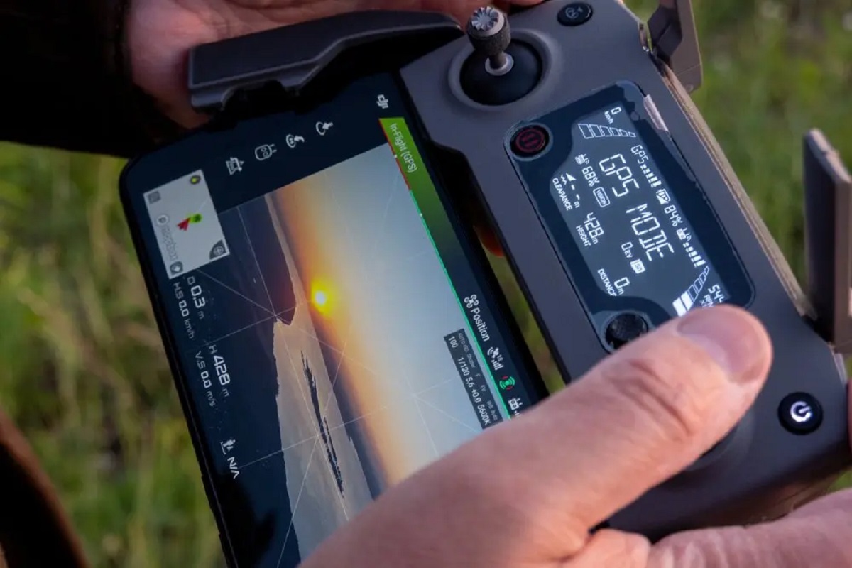
2. GPS Accuracy and Stability: Look for drones with high GPS accuracy to ensure precise positioning and navigation. A stable GPS connection is crucial for reliable flight control and accurate waypoint navigation.
3. Camera Quality: If aerial photography or videography is your primary goal, pay attention to the camera specifications. Look for drones that offer high-resolution imaging capabilities, image stabilization features, and the ability to tilt or rotate the camera for versatile shots.
4. Intelligent Flight Modes: Consider drones that offer intelligent flight modes such as follow me, waypoint navigation, and orbit. These modes enhance the flying experience and provide opportunities for creative and dynamic shots.
5. Control Range and Signal Strength: Check the maximum control range of the drone, which determines how far it can be flown from the remote controller. Also, evaluate the signal strength to ensure a reliable connection between the drone and controller, particularly in areas with potential interference.
6. Safety Features: Look for drones with built-in safety features, such as obstacle avoidance systems, return-to-home functions, and geofencing capabilities. These features can help prevent collisions, ensure the safe return of the drone, and comply with airspace regulations.
7. Portability and Durability: Consider the size and weight of the drone, especially if you need to transport it frequently. Opt for a compact and lightweight model that is easy to carry. Additionally, check if the drone is designed to withstand minor crashes and is made of durable materials.
8. Controller and App Compatibility: Assess the controller’s ease of use, ergonomic design, and compatibility with your mobile device. Also, check if the drone has a dedicated app that offers additional features, live video streaming, or advanced flight settings.
9. Price and Budget: Determine your budget and consider the price range of GPS drones available in the market. Remember to compare the features, specifications, and overall value for money offered by different models.
10. Customer Reviews and Reputation: Research customer reviews and the reputation of the drone manufacturer. Take into account the experiences and feedback of other users to gain insights into the drone’s performance, reliability, and customer support.
By considering these factors, you can make an informed decision and select a GPS drone that meets your requirements and enhances your aerial missions.
Top GPS Drones in the Market
With the growing popularity and advancements in drone technology, there are several top-quality GPS drones available in the market. These drones offer advanced features, reliable flight performance, and high-quality cameras. Here are some of the top GPS drones in the market today:
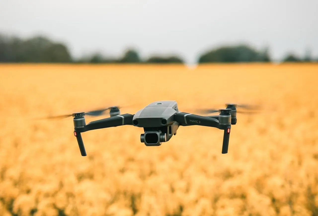
1. DJI Mavic 2 Pro: The DJI Mavic 2 Pro is a compact and powerful GPS drone with a Hasselblad camera that captures stunning 20-megapixel photos and 4K videos. It offers advanced obstacle sensing and intelligent flight modes, including ActiveTrack 2.0 and Hyperlapse.
2. Autel Robotics EVO II: The Autel Robotics EVO II boasts an impressive 40-minute flight time and a 1-inch sensor camera capable of capturing 8K video and 48-megapixel stills. It features advanced autonomous flight modes and a robust GPS system for precise positioning.
3. Skydio 2: The Skydio 2 is a highly autonomous GPS drone that excels in obstacle avoidance. It uses AI-powered technology to navigate complex environments smoothly. With a 4K camera and intelligent flight modes, it is ideal for capturing dynamic aerial footage.
4. DJI Phantom 4 Pro V2.0: The DJI Phantom 4 Pro V2.0 is a professional-grade GPS drone with a 20-megapixel camera capable of shooting 4K video at 60fps. It offers advanced flight features, including obstacle avoidance, TapFly, and ActiveTrack, along with precise GPS navigation.
5. Yuneec Typhoon H Pro: The Yuneec Typhoon H Pro is a hexacopter GPS drone equipped with a 4K camera mounted on a 3-axis gimbal. It provides stable and smooth aerial shots and offers intelligent flight modes like orbit, follow me, and waypoint navigation.
6. Parrot Anafi: The Parrot Anafi is a compact and portable GPS drone with a 4K HDR camera that can tilt upward by 180 degrees. It offers advanced flight modes, including Follow Me and Waypoints, and has a flight time of up to 25 minutes.
7. Holy Stone HS720: The Holy Stone HS720 is a budget-friendly GPS drone with a 4K camera that captures high-quality photos and videos. It features GPS-assisted flight, including follow me mode and tap fly, and has a flight time of approximately 26 minutes.
8. Autel Robotics X-Star Premium: The Autel Robotics X-Star Premium is a reliable GPS drone with a 4K Ultra HD camera that captures smooth and stable footage. It offers intelligent flight modes, including orbit and follow, and has a long-distance control range of up to 1.2 miles.
These are just a few examples of the top GPS drones available in the market. Each drone offers unique features and capabilities, so it’s important to consider your specific requirements and budget when making a purchase decision.
Conclusion
GPS drones have revolutionized the way we approach aerial missions, providing advanced navigation capabilities, precise positioning, and autonomous flight control. These drones offer a range of benefits in various industries, from aerial photography and agriculture to infrastructure inspection and search and rescue operations.
When purchasing a GPS drone, it’s crucial to consider factors such as flight time, GPS accuracy, camera quality, intelligent flight modes, and safety features. The market offers a wide range of GPS drones, each with its own unique features and capabilities.
Some of the top GPS drones in the market include the DJI Mavic 2 Pro, Autel Robotics EVO II, and Skydio 2, which offer advanced obstacle avoidance, high-resolution cameras, and intelligent flight modes. Other options like the DJI Phantom 4 Pro V2.0, Yuneec Typhoon H Pro, Parrot Anafi, Holy Stone HS720, and Autel Robotics X-Star Premium cater to different needs and budgets.
By carefully considering these factors and exploring the available options, you can choose a GPS drone that suits your specific requirements and empowers you to capture stunning aerial footage, execute precise missions, and unlock new possibilities for innovation in your field.
Whether you are an aerial photographer, a farmer optimizing crop production, an infrastructure inspector, or someone exploring the exciting world of drone technology, a GPS drone can be a valuable partner to aid you in your endeavors.
So, take your time, do thorough research, and make an informed decision when selecting a GPS drone. Embrace the power of GPS technology and embark on your aerial adventures with confidence, knowing that you have a reliable and versatile tool at your disposal.