Introduction
Welcome to the fascinating world of RTK drones! In this ever-evolving era of technology, drones have become versatile tools that have revolutionized various industries. The introduction of RTK (Real-Time Kinematic) technology has further enhanced the capabilities and precision of drones, making them indispensable for aerial mapping, surveying, inspection, and more.
But what exactly is an RTK drone? How does this technology work, and what are its benefits and limitations? In this article, we will explore the ins and outs of RTK drones, their applications, and what factors to consider when choosing one.
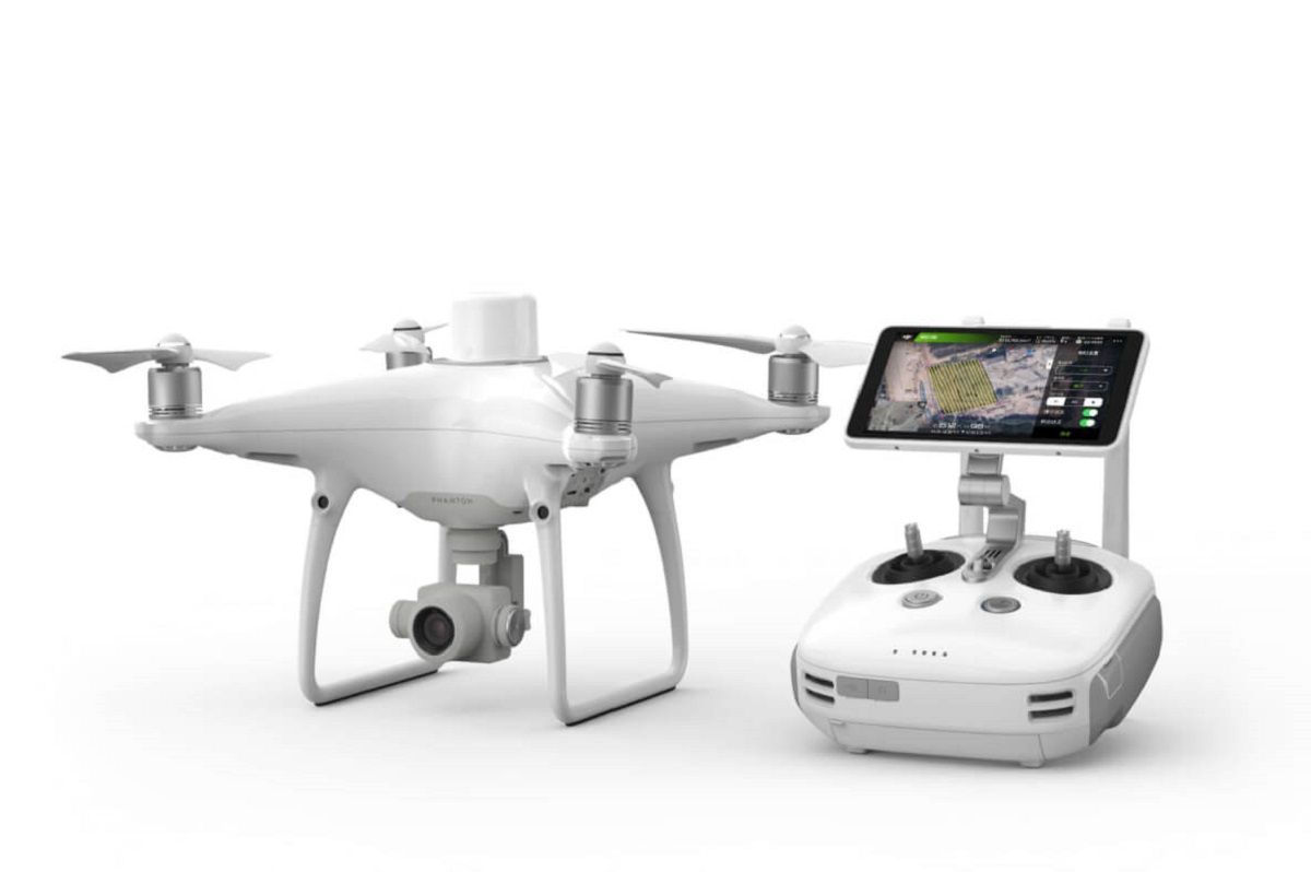
An RTK drone is a type of unmanned aerial vehicle (UAV) equipped with a GNSS (Global Navigation Satellite System) receiver that utilizes RTK technology for precise positioning and navigation. RTK technology enhances the accuracy of the drone’s GPS (Global Positioning System) by correcting errors caused by atmospheric interference and signal delays.
So how does RTK technology work? Essentially, it uses a fixed base station that receives signals from multiple GNSS satellites and calculates its precise location. This base station then transmits correction data to the RTK drone in real-time, allowing the drone to adjust its GPS coordinates to achieve centimeter-level accuracy.
The benefits of using an RTK drone are numerous. One of the major advantages is its superior accuracy, enabling professionals in fields like surveying and mapping to achieve highly precise measurements and create detailed 3D models of terrain and structures. This level of accuracy can significantly streamline workflows and reduce the need for ground-based measurements, saving time and resources.
In addition to accuracy, RTK drones also offer increased efficiency. With precise positioning, these drones can autonomously follow pre-defined flight paths, capturing images or collecting data at regular intervals. This automation not only improves overall productivity but also reduces the risk of human error.
The applications of RTK drones are vast and diverse. They are extensively used in industries such as agriculture, construction, engineering, environmental monitoring, and even filmmaking. In agriculture, for example, RTK drones can help optimize crop management by providing crucial data on soil moisture, nutrient levels, and plant health. In construction and engineering, they can aid in site planning, progress monitoring, and high-precision mapping of terrain and infrastructure.
When it comes to choosing an RTK drone, there are several factors to consider. Firstly, you need to assess your specific requirements and ensure that the drone’s capabilities align with your needs. Consider factors such as flight time, payload capacity, camera specifications, and compatibility with mapping software.
It’s also essential to evaluate the reliability and accuracy of the RTK system. Look for drones with reputable GNSS receivers and reliable base station networks or the option to set up your own base station.
Nevertheless, it’s important to acknowledge the limitations of RTK drones. They may struggle to maintain a stable connection in areas with poor satellite visibility or significant obstructions like tall buildings or dense trees. Moreover, weather conditions and atmospheric disturbances can affect the accuracy of the RTK system temporarily.
Overall, RTK drones are powerful tools that bring unprecedented precision and efficiency to a wide range of industries. With their ability to achieve centimeter-level accuracy and their versatility in various applications, it’s no wonder that RTK drones are becoming increasingly popular. Whether you’re a surveyor, researcher, farmer, or filmmaker, exploring the possibilities of RTK drones can unlock new dimensions of success in your field.
What is an RTK Drone?
An RTK drone is a type of unmanned aerial vehicle (UAV) that utilizes Real-Time Kinematic (RTK) technology for precise positioning and navigation. It is equipped with a GNSS (Global Navigation Satellite System) receiver, typically a high-precision GPS module, which allows the drone to achieve centimeter-level accuracy in its positioning.
RTK technology is a technique used to enhance the accuracy of GPS positioning. It works by correcting errors caused by atmospheric interference, signal delays, and other factors that can affect GPS accuracy. This is achieved by using a fixed base station, which serves as a reference point and calculates its precise coordinates using signals from multiple GNSS satellites.
The base station then sends correction data to the RTK drone in real-time, enabling it to adjust its GPS coordinates accordingly. This continuous feedback loop between the base station and the drone ensures that the drone’s position is highly accurate and reliable, even in challenging environments or areas with limited satellite visibility.
RTK drones offer a significant advantage over traditional GPS-enabled drones that rely solely on the satellite-based positioning system. While standard GPS can provide accuracy within a few meters, RTK technology can achieve accuracy down to the centimeter level. This level of precision opens up new possibilities in industries that require highly accurate measurements and mapping.
The applications of RTK drones are vast and diverse. In the field of surveying and mapping, RTK drones can be used to create detailed 3D models and maps of terrain and structures. With their ability to achieve high accuracy, they can provide invaluable data for construction planning, land surveying, and infrastructure inspection.
Agriculture is another area where RTK drones have proven to be instrumental. These drones can be used to monitor crop health, assess soil conditions, and optimize irrigation and fertilization strategies. With the ability to precisely map farmland, farmers can make informed decisions and improve overall crop yield and efficiency.
Environmental monitoring is yet another application of RTK drones. They can be used to survey and monitor areas affected by natural disasters, assess the health of ecosystems, and track changes in vegetation and wildlife patterns. The accurate data gathered by RTK drones can aid in effective environmental management and conservation efforts.
Overall, RTK drones have revolutionized the way we collect data and conduct various tasks. Their precision and versatility make them valuable tools for professionals in fields such as surveying, agriculture, construction, environmental monitoring, and more. With the ability to achieve centimeter-level accuracy and the advancements in technology, RTK drones continue to push the boundaries of what is possible in the realm of aerial data collection and mapping.
How does RTK Technology Work?
RTK (Real-Time Kinematic) technology is a technique used to enhance the accuracy of GPS (Global Positioning System) positioning. It works by correcting errors caused by atmospheric interference, signal delays, and other factors that can affect the accuracy of GPS measurements.
At the core of RTK technology is a process known as differential positioning. It involves comparing the measurements acquired by a stationary reference receiver, called the base station, with those acquired by the moving receiver, such as an RTK drone. The base station is positioned at a known location with precisely determined coordinates.
The base station receives signals from multiple GNSS (Global Navigation Satellite System) satellites, such as GPS, GLONASS, Galileo, or BeiDou. These satellite signals contain information about the precise location of each satellite, known as ephemeris data.
Using the ephemeris data, the base station calculates its own precise position, also known as the reference position. This position serves as a reference point for the RTK drone and is used to estimate the errors present in the raw GPS measurements due to factors like atmospheric delays and clock inaccuracies.
The base station then transmits correction data to the RTK drone in real-time. This correction data includes the estimated errors in the GPS measurements and is used by the drone’s onboard receiver to adjust its own GPS positions.
By applying the received correction data, the RTK drone can compensate for errors in its measurements and achieve highly accurate positioning. The continuous feedback loop between the base station and the drone allows for real-time adjustments, ensuring that the drone’s position remains precise even as it moves and encounters environmental influences.
For the RTK technology to work effectively, the base station and the drone must be within a certain range of each other. This range is typically limited to a few kilometers, depending on the specific RTK system being used and the signal quality.
The accuracy achieved by RTK technology is significantly higher than that of standard GPS positioning. While GPS can provide position accuracy within a few meters, RTK technology can achieve accuracy down to the centimeter level. This level of precision makes RTK drones ideal for applications that require highly accurate measurements, mapping, and surveying.
In addition to the base station, some RTK systems also use a virtual reference station or network of reference stations. These virtual reference stations calculate and transmit the correction data to the RTK drone, offering greater flexibility in terms of positioning and access to correction data even in areas where physical base stations may be limited.
Overall, RTK technology plays a crucial role in enabling RTK drones to achieve exceptional accuracy in their positioning. By continuously receiving correction data from a reference station or network of stations, these drones can overcome the inherent errors of GPS measurements and deliver precise results that are essential in a wide range of applications.
Benefits of RTK Drones
RTK (Real-Time Kinematic) drones come with a range of advantages that make them invaluable tools in various industries. The benefits of using RTK drones extend beyond their superior positioning accuracy, offering enhanced efficiency, improved productivity, and cost savings. Let’s explore some of these key benefits:
1. Precise Positioning: The primary benefit of RTK drones is their ability to achieve centimeter-level accuracy in positioning. This level of precision is crucial in applications such as surveying, mapping, and construction, where accurate measurements are essential. With RTK technology, professionals can obtain highly precise data, resulting in accurate 3D models and maps.
2. Increased Efficiency: RTK drones streamline workflows by automating repetitive tasks. With precise positioning, these drones can autonomously follow pre-defined flight paths and capture images or collect data at regular intervals. This automation reduces the need for manual intervention, saving time and effort while capturing data consistently and efficiently.
3. Time and Cost Savings: Traditional surveying or mapping methods often involve time-consuming and labor-intensive processes. RTK drones can significantly reduce the time and cost associated with such tasks. By collecting accurate and comprehensive data efficiently, professionals can save on resources and complete projects faster, leading to overall cost savings.
4. Enhanced Safety: RTK drones improve safety by reducing or eliminating the need for professionals to work in hazardous or challenging environments. With highly accurate positioning, these drones can be used for inspecting infrastructure, monitoring difficult-to-reach areas, or assessing potential risks without human operators needing to physically access dangerous locations.
5. Versatility: RTK drones offer versatility in terms of applications. They can be used in various industries such as agriculture, construction, environmental monitoring, and more. Whether it’s optimizing crop management, assessing construction site progress, or monitoring ecological changes, RTK drones provide valuable data for decision-making across diverse sectors.
6. Better Data Quality: The high accuracy and reliability of RTK drones result in improved data quality. In sectors like agriculture, the precise data obtained by RTK drones can be used to make data-driven decisions related to irrigation, fertilization, and pest control, leading to improved crop yield and resource management.
7. Flexibility: RTK drones offer flexibility in terms of flight planning and data collection. With their advanced navigation capabilities, they can adapt to challenging terrain or restricted areas, ensuring comprehensive coverage and accurate data collection where it may otherwise be difficult or impossible.
8. Integration with Mapping Software: RTK drones can seamlessly integrate with various mapping and surveying software. This compatibility enhances the process of data analysis and mapping by allowing professionals to easily process, analyze, and visualize the collected data, further enhancing the value and usability of the drone-acquired data.
Collectively, these benefits make RTK drones a superior choice for professionals who require high-precision data and efficient data collection capabilities. Whether it’s streamlining workflows, improving project timelines, or making informed decisions based on accurate data, the advantages of RTK drones can have a profound impact on the success and efficiency of operations across various industries.
Applications of RTK Drones
RTK (Real-Time Kinematic) drones have a wide range of applications across various industries, thanks to their ability to achieve centimeter-level accuracy in positioning and their versatility in data collection. Let’s explore some of the key applications where RTK drones have proven to be highly valuable:
1. Surveying and Mapping: RTK drones are extensively used in the field of surveying and mapping. They can create highly accurate 3D models, orthomosaic maps, and point clouds of terrain, buildings, and infrastructure. These precise measurements and visual representations are essential for land surveying, urban planning, construction site analysis, and infrastructure management.
2. Agriculture: RTK drones play a crucial role in modern agriculture. They can be used for crop monitoring, field mapping, and precision agriculture. With the ability to capture high-resolution images and collect data on soil composition, crop health, and vegetation indices, farmers can make informed decisions about irrigation, fertilization, and pest control, leading to optimized crop yields and resource management.
3. Infrastructure Inspection: RTK drones are ideal for inspecting infrastructure such as bridges, buildings, power lines, and pipelines. With their precise positioning capabilities, they can capture detailed images and videos of critical infrastructure components, allowing professionals to assess structural integrity, detect defects, and plan maintenance or repairs more effectively.
4. Environmental Monitoring: RTK drones are invaluable tools for environmental monitoring and conservation efforts. They can be used to assess changes in vegetation coverage, monitor wildlife populations, track soil erosion, and analyze water pollution. The high-resolution and accurate data collected by RTK drones aid researchers and conservationists in understanding environmental changes and implementing effective management strategies.
5. Film and Media Production: RTK drones have transformed the film and media production industry by providing stunning aerial shots and dynamic perspectives. With their precise positioning, these drones can capture cinematic footage for movies, commercials, documentaries, and other visual productions, giving filmmakers access to unique and visually captivating shots.
6. Emergency Response: During natural disasters or emergency situations, RTK drones can assist with rapid assessment and response. They can quickly survey affected areas, identify hazards, locate survivors, and provide crucial real-time information to first responders. With their ability to access hard-to-reach or hazardous locations, RTK drones aid in the efficient management of emergency situations.
7. Construction and Engineering: RTK drones have become instrumental in the construction and engineering industry. They can assist in site planning, progress monitoring, and volume calculations. With their accurate mapping capabilities, RTK drones enable professionals to track project development, assess earthwork quantities, and streamline construction workflows, leading to improved efficiency and cost savings.
These are just a few examples of the wide range of applications for RTK drones. From surveying and agriculture to infrastructure inspection and emergency response, the accurate and reliable data collected by RTK drones has transformed various industries. As technology continues to advance, RTK drones will continue to find new and innovative applications, enhancing productivity, safety, and decision-making processes.
Factors to Consider When Choosing an RTK Drone
When selecting an RTK (Real-Time Kinematic) drone, there are several crucial factors to consider to ensure that the drone meets your specific requirements and delivers reliable and accurate results. Here are some key factors to keep in mind:
1. Flight Performance and Endurance: Assess the flight performance and endurance of the RTK drone. Consider factors such as flight time, maximum range, and payload capacity. A drone with longer flight time and extended range can cover larger areas and collect more data before needing to return for recharging or swapping batteries.
2. GNSS Receiver and RTK System: The accuracy of an RTK drone relies on the quality and capabilities of its GNSS receiver and the RTK system it uses. Look for drones that feature reputable and reliable GNSS receivers with compatibility for multiple satellite systems, such as GPS, GLONASS, Galileo, or BeiDou. Consider whether the drone has its own RTK system or if it requires a fixed base station or access to a network of reference stations.
3. Camera Specifications: If your application involves aerial imaging or photogrammetry, consider the camera specifications of the RTK drone. Look for drones with high-resolution cameras, adjustable gimbal stabilization, and the ability to capture RAW or high-quality images. Some drones also offer additional camera features like thermal imaging or multispectral sensor capabilities for specialized applications.
4. Software Compatibility: Assess the compatibility of the RTK drone with mapping and surveying software. Ensure that the drone can easily integrate with the software you plan to use for data processing, analysis, and visualization. Compatibility with popular software solutions simplifies the workflow and ensures seamless data transfer and processing.
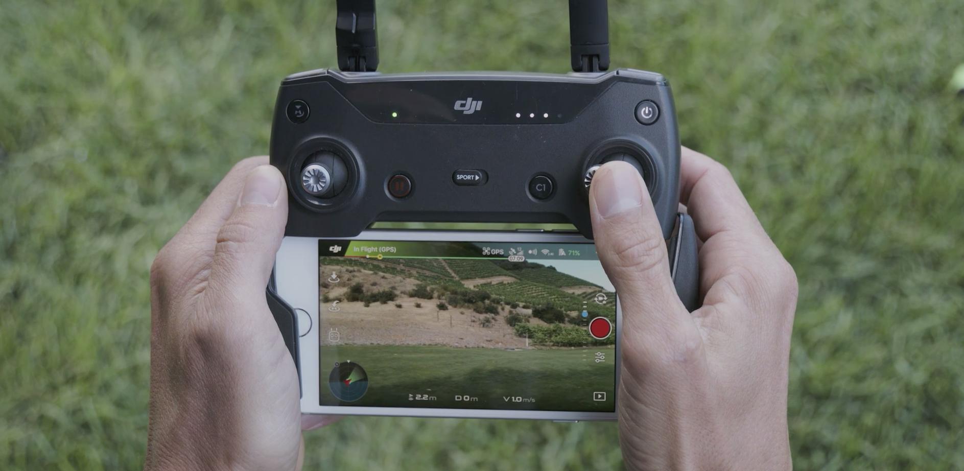
5. Controller and Ground Control System: Evaluate the controller and ground control system that comes with the RTK drone. Look for intuitive and user-friendly interfaces that enable effortless flight planning, autonomous navigation, and data collection. Consider the range and reliability of the controller, as well as the availability of additional features like real-time data monitoring and mission planning tools.
6. Data storage and Transfer: Consider the data storage and transfer capabilities of the RTK drone. Look for drones that offer ample storage capacity, either through onboard storage or removable memory cards. Additionally, assess the ease and speed of data transfer from the drone to external devices for further analysis or processing.
7. Build Quality and Durability: Assess the build quality and durability of the RTK drone, especially if you plan to use it in challenging or rugged environments. Look for drones that are constructed with sturdy and durable materials, with features like water and dust resistance. This ensures that the drone can withstand harsh weather conditions or accidental impacts, resulting in increased reliability and longevity.
8. Customer Support and Warranty: Consider the customer support and warranty provided by the drone manufacturer. Ensure that there is reliable customer support available for technical assistance or troubleshooting. Additionally, check the warranty terms and conditions to ensure adequate coverage for potential issues or defects.
By carefully considering these factors, you can choose an RTK drone that aligns with your specific needs and delivers the accuracy and reliability required for your applications. It’s essential to thoroughly research and compare different drone models, read customer reviews, and consult with professionals in your industry to make an informed decision.
Limitations of RTK Drones
While RTK (Real-Time Kinematic) drones offer numerous benefits and highly accurate positioning, it’s important to consider their limitations before incorporating them into your workflows. Understanding these limitations will help you manage expectations and make informed decisions. Here are some key limitations to keep in mind:
1. Signal Range: RTK drones rely on a continuous signal connection between the drone and the base station or reference network for accurate positioning. The range of this signal is limited, typically up to a few kilometers. Beyond this range, the signal may weaken, leading to decreased accuracy or loss of positioning capabilities.
2. Satellite Visibility: The accuracy of RTK positioning depends on the availability of satellite signals. In obstructed areas, such as dense forests or urban canyons, where satellite visibility is limited, the RTK drone may struggle to maintain a stable connection or may experience intermittent outages, leading to reduced accuracy or temporary positioning errors.
3. Obstruction Interference: Tall buildings, mountains, or other structures can obstruct satellite signals, causing signal reflections, multi-path errors, or complete loss of signal lock. When using an RTK drone in such areas, the accuracy of the positioning may be compromised due to these obstructions affecting the integrity of the RTK system.
4. Weather Conditions: Adverse weather conditions, such as heavy rain, snowfall, or strong winds, can affect the accuracy of RTK positioning. Atmospheric interference and signal absorption or scattering can temporarily degrade the signals received by the drone, resulting in reduced accuracy or momentary positioning fluctuations. It’s advisable to avoid flying an RTK drone in extreme weather conditions to ensure reliable and accurate positioning.
5. Base Station Availability: Some RTK systems require the use of a fixed base station or access to a network of reference stations to provide correction data to the drone. Depending on your location or the availability of such base stations, it may limit the usability of the RTK drone. Setting up your own base station can be costly and time-consuming, especially in remote or inaccessible areas.
6. System Complexity: RTK technology involves complex processes, including data acquisition, correction calculations, and real-time transmission. The setup and operation of an RTK drone system may require technical expertise and training. It’s important to have personnel with knowledge and experience in operating and troubleshooting RTK drones to ensure the system functions properly and delivers accurate results.
7. Additional Investment: RTK drones are often more expensive than traditional GPS-enabled drones. Their higher price is justified by their increased accuracy and advanced positioning capabilities. However, it’s essential to consider the potential additional investment in RTK technology, such as base stations, reference networks, or software licenses, as they may be required to fully leverage the benefits of RTK positioning.
Despite these limitations, RTK drones continue to provide accurate and reliable positioning for various industries. By being aware of these limitations and proactively managing them, professionals can maximize the effectiveness of RTK drones and leverage their benefits in applications that require highly accurate positioning and data collection.
Conclusion
RTK (Real-Time Kinematic) drones have transformed the way we collect data, conduct surveys, and perform various tasks across numerous industries. With their ability to achieve centimeter-level accuracy in positioning, RTK drones offer unprecedented precision and efficiency, resulting in improved productivity, cost savings, and data quality.
Throughout this article, we explored what RTK drones are and how they work. We also delved into the benefits and limitations of using RTK drones in different applications.
The benefits of RTK drones are vast. These drones provide highly accurate positioning, allowing professionals in industries such as surveying, agriculture, and construction to achieve precise measurements and create detailed 3D models and maps. The increased efficiency and time savings offered by RTK drones streamline workflows and reduce human error, while the versatility of these drones enables their use in a wide range of applications.
However, it’s crucial to be aware of the limitations of RTK drones. Factors such as signal range, satellite visibility, and weather conditions can impact the accuracy and reliability of positioning. Additionally, the setup and operation of RTK systems may require technical expertise and involve additional investments.
Despite these limitations, RTK drones continue to revolutionize industries and open up new possibilities for data collection and analysis. As technology advances and the availability of base stations and reference networks improves, the limitations of RTK drones can be mitigated, allowing for even greater accuracy and reliability in positioning.
When considering an RTK drone, it’s important to carefully evaluate factors such as flight performance, GNSS receiver and RTK system, camera specifications, software compatibility, build quality, and customer support. By selecting a drone that aligns with your specific needs and offers the required capabilities, you can maximize the benefits of RTK technology in your applications.
In conclusion, RTK drones have become invaluable tools in a wide range of industries. Their ability to achieve centimeter-level accuracy, coupled with automation and versatility, has transformed the way professionals collect data, monitor environments, and make informed decisions. By understanding the capabilities, benefits, and limitations of RTK drones, professionals can harness their power to drive efficiency, improve productivity, and unlock new opportunities for success.